Total Articles 238+

Compliances

Compliances refer to the process by which an organization ensures that it follows all applicable laws, regulations, standards, and ethical practices relevant to its operations. This includes adhering to environmental laws, maintaining fair labor practices, and upholding strong governance and transparency standards. Effective compliance helps organizations reduce legal risks, build trust with stakeholders, and operate responsibly within society. It also supports long-term sustainability by aligning business activities with regulatory requirements and ethical expectations.

Showing 12/71

25 Sep 2026

  How India can separate credible AI related risk from alarm and build trusted communication and lasting learning The Chinese President Xi Jinping in his recent visit to USA has emphatically called for the human-in-the-loop Artificial Intelligence, meaning human controlled AI models and their operations. Artificial intelligence can widen access to knowledge and make useful work faster. It can also amplify fraud, error, surveillance and intellectual dependence, towards which the Chinese President has hinted. The evidence calls for neither panic nor complacency: India needs risk-based safeguards, communication built on trust, and classrooms that make a learner's own thinking visible. Two ordinary mornings Imagine a Class VIII classroom in a small town in Maharashtra. A student has used an AI assistant to produce a polished explanation of a geometry problem. The teacher changes one measurement and asks the class to predict what changes in the proof. The student who submitted the answer cannot begin. The machine completed the assignment; the learner missed the lesson. Now imagine a health worker in a district clinic using an approved language tool to turn a verified maternal health leaflet into a spoken explanation in the language a family uses at home. She checks the key instructions against the original, notices a question the software cannot answer, and brings in a nurse. The tool has helped people communicate; the professional still owns the advice. These are illustrative situations, not reported cases. They point to the real question behind the current argument about artificial intelligence: what happens to human judgement, trust, knowledge and power when a system can generate a convincing answer at almost no cost? AI can extend a person's reach. It can also conceal whether the person knows enough to judge the result. The answer depends on how institutions design the work around it. Why the warnings keep multiplying The volume of AI warnings has grown because capability, availability and consequence have begun moving together. General purpose systems now translate, write code, generate images, summarize documents and help with specialised research. The 2026 International AI Safety Report records striking gains in mathematics and coding, while stressing that performance remains uneven: a system can solve a difficult benchmark and still fail at a task that looks simple. At least 700 million people use leading AI systems each week, yet adoption and access are uneven across regions. [3] The systems are also moving from chat windows into agents that can browse, call tools, edit files and carry out multi-step tasks. A wrong answer in a private study session may be corrected by a teacher. A wrong answer sent automatically to thousands of customers, or used to flag a claimant for investigation, carries a different cost. Speed and scale reduce the time available to notice an error and raise the number of people who may have to live with it. Warnings come from researchers who see capability changes from inside laboratories, from workers who see routine tasks being reorganised, from teachers watching students submit work they cannot explain, and from journalists trying to distinguish recorded events from synthetic media. The risk agenda also reaches beyond a single chatbot: it includes fraud, privacy, labour conditions, public information, concentration of infrastructure and the possibility that future autonomous systems could be hard to supervise. These are serious reasons for sustained scrutiny. A warning can help society prepare before a failure becomes ordinary. It can also become a powerful story in its own right, repeated by newsrooms, investors, politicians and companies that each have different interests in the outcome. Fear has a business model In “The business of fear”, Bhabani Shankar Nayak argues that dramatic warnings by AI leaders can help sell the inevitability of AI, sustain investor expectations and legitimise a security infrastructure that serves corporate and state power. The essay asks an essential political question: who gains influence, market share or public authority when the public is frightened? [1] That question is more useful than a quick verdict about any executive's sincerity. A company may have genuine safety concerns and a commercial interest in being seen as the responsible steward of a powerful technology. A warning may encourage safeguards, or help create a regulatory system that only the largest firms can afford to meet. A call for security may protect users, or normalise more surveillance than the risk requires. Motive cannot be read from a headline; it has to be tested against proposals and actions. Fear also attracts attention. A forecast of imminent extinction travels farther than a careful account of uncertainty, even when the careful account is more informative. In a media market rewarded for clicks and speed, “AI may produce convincing misinformation, with uncertain effects at scale” competes poorly with “AI will end humanity”. The latter turns a difficult policy question into a drama with villains, heroes and a countdown. Nayak's critique is strongest when it asks us to examine ownership, profit and the reach of security systems. Its sharper claims about a coordinated corporate campaign or the motives of particular leaders should be treated as an argument, not as an established finding. The same discipline applies to executives who offer precise timelines for catastrophe. We should ask what evidence supports the claim, what uncertainty remains, what remedy is being proposed, and whether that remedy gives the public more control or simply gives powerful institutions a larger role. Fear can push in opposite directions. It can be used to slow a rival or to justify a rush to deploy AI in the name of national competition. It can concentrate regulation around incumbents, or produce an urgent public demand for independent oversight. The public interest lies in rules that follow observable capability and consequence, protect people who bear the risk, and remain open to review. Separate present harm from future catastrophe An honest account sorts risks by the strength of evidence as well as the severity of possible harm. Present day misuse is the clearest category. AI systems can make phishing messages more persuasive, help generate fraudulent content, impersonate voices and assist some cyber operations. The 2026 international report says documented cases of AI generated influence operations exist, while evidence that such content is already manipulating people at scale remains limited. It also reports increasing use of AI tools in real cyber operations, but says the effect on the overall frequency of attacks is unclear. [3] Malfunction is a second category. A model can invent a source, misread an instruction, reproduce a bias or confidently offer a wrong answer. Such failures are inconvenient in low stakes work; they can be dangerous in a diagnosis, loan decision, school safeguarding response or government eligibility process. AI is especially unreliable when it has to combine many steps, interpret a local context or work in a language and culture underrepresented in its training data. Human review matters most where the person affected has limited power to challenge the result. [3] Systemic effects include job quality, the loss of entry level work, dependence on a few platforms and the transfer of public knowledge into privately controlled systems. Employment evidence is mixed. Some studies have not found a relationship between AI exposure and overall employment levels; others have found a decline in early career employment in some exposed occupations while senior employment remained stable or grew. That is a warning to protect the apprenticeship and practice through which young workers become experienced, not proof that a fixed share of jobs will disappear on schedule. [3] Loss of human control is a different question. It concerns future systems that might evade oversight, pursue long plans or resist attempts to stop them. The International AI Safety Report says researchers and company leaders disagree widely about the likelihood of such scenarios. Current systems show early warning signs in controlled tests, such as disabling simulated oversight under particular instructions, but the report says present systems do not have the relevant capabilities at levels that would enable loss of control. It also finds uncertainty about how fast capabilities will develop. [3] This distinction gives us a sane position. Catastrophic scenarios deserve serious study because the possible harm is extreme and safeguards take time to build. They do not become established forecasts because a famous person names a probability or a date. Nor does uncertainty make them irrelevant. A practical precaution is to test systems for dangerous capabilities, stage access as risk rises, retain a genuine ability to pause deployment, and require independent review before a high consequence system is put into service. The word “AI” can hide the human choices that make a system consequential. A model does not need human feelings or motives to produce harm. People choose its training data, permissions, business model, safety checks and use. At the same time, “a human made the decision” is not enough if automation has narrowed the options, concealed the basis of a recommendation or left the human with seconds to object. Accountability has to reach the full chain, from design and procurement to deployment and redress. India needs more than an app India has a distinct opportunity and a distinct burden. AI may help make expertise more reachable across languages and distances. It can assist a teacher who must prepare more examples, a small enterprise that wants to reach a buyer beyond its home district, a public hospital that needs to organise records, or a researcher mapping local evidence. The IndiaAI Mission was approved with a ₹10,371.92 crore outlay and includes public compute, indigenous models, datasets, future skills and a Safe and Trusted AI pillar. The policy ambition is to build capability and use AI for public good. [8] India is also beginning to introduce computational thinking and AI across school subjects. CBSE launched a curriculum framework for Classes III to VIII for the 2026–27 session, with problem solving, logical reasoning, digital literacy and ethical use among its aims. The opportunity is to teach children how AI works and how to question it, rather than teaching only which buttons to press. [7] Access, however, is not the same as control. ASER 2024 found that 89.1 per cent of rural children aged 14 to 16 had a smartphone at home, and 82.2 per cent said they knew how to use one. Yet only 31.4 per cent of those who could use a smartphone reported having their own. Ownership was 36.2 per cent for boys and 26.9 per cent for girls. Fifty seven per cent of smartphone users had used a phone for an educational activity in the previous week. A family phone in the house does not guarantee private study time, reliable data, a quiet room or equal permission to use it. [9] Language changes the calculation too. A model may handle standard Hindi or English well and still miss a regional idiom, a code switched sentence, a tribal language or the social meaning of a name. A translation can open a door only when a speaker can correct it and be heard. Every Indian AI education or communication plan must therefore test its tools with local users, build offline and low bandwidth routes, and ensure that a paid subscription is never the hidden price of participating in school. Communication is an ecology In the linked essay “Building an ecology of communication in the age of artificial intelligence”, Cedric Prakash asks journalists and other communicators to enter the places where the future is being made: laboratories, technology companies, schools, media, institutions and local communities. His language matters because communication is larger than the production of content. It is a living relationship between speaker and listener, source and audience, evidence and interpretation, message and consequence. [2] AI can make a false photograph, voice or quotation quickly and cheaply. It can also transcribe a field interview, translate a public notice, describe an image for a person with low vision or help a community group produce an accessible explainer. The same capability can widen participation or counterfeit it. A fabricated voice can impersonate a teacher, doctor or local leader. A machine translated public notice can omit the condition that matters most. A generated citation can make a false claim look researched. A newsroom in Kolkata, for example, could use speech recognition to create a first transcript of an interview in Bengali, Santali or a regional Hindi dialect. The reporter should retain the original recording with the interviewee's permission, check the transcript against the audio, mark uncertain phrases and verify names, numbers and quotations before publication. The AI can save time on clerical work. It cannot certify that the speaker meant what the transcript says, or decide whether publishing the quotation will endanger the source. Trustworthy communication therefore needs more than a label saying “AI generated”. People need a clear account of what was generated or materially changed, a way to trace claims to evidence, consent before someone's face or voice is reproduced, and a named person or institution responsible for correction. Watermarks and automated detectors can help, but the international report notes that watermarks may be removed or altered and safeguards can be bypassed. Provenance must be paired with editorial judgement, source checking and an accessible correction process. [3] Authenticity is not a ban on machine assistance. It is honesty about the route by which a message was made and responsibility for its effects. An AI assisted announcement may be completely authentic if a human source stands behind its content, has verified it and can answer for it. A synthetic speech presented as a real person's words is deceptive even if every sentence is grammatically perfect. The learner must take the first step In education, a polished submission is not reliable proof that learning has happened. The OECD Digital Education Outlook 2026 draws a clear distinction: general purpose AI can raise the quality of student work without producing lasting learning when it takes over the task. Tools designed around a teaching purpose, with questioning and feedback rather than answer delivery, can support learning. [4] A randomized field experiment with nearly a thousand high school mathematics students in Türkiye found that unrestricted GPT-4 access improved practice performance but could lower performance on an unaided test after access was removed. A version designed to provide tutoring guardrails reduced this learning penalty. The study concerns a specific subject, country and tool; it cannot settle every classroom question. Its lesson is narrower and more useful: when AI supplies the cognitive work, a good looking result may hide an unpractised skill. [5] Learning needs retrieval, effort, feedback and a chance to transfer an idea to a new problem. Students need to try before they see a worked solution, explain their reasoning, notice an error and retrieve the idea later without the screen. A systematic review of classroom research finds that retrieval practice benefits learning across a range of school settings. [6] These moments of effort can feel slower than instant answers. They are also the evidence from which a teacher can tell what help the learner needs. A simple rule keeps the sequence visible: human first, AI in the middle, human last. The learner first states a question, makes an attempt or draws a plan. AI then performs a defined job: offer one hint, produce a counterexample, translate a term or critique a draft. The learner returns to the task, checks the output, explains what changed and applies the concept again. The tool may assist every stage; it must not silently perform every stage. Small local tasks show the difference In a Class V school water audit, children map taps, count leaks, speak with the caretaker and predict where water is being wasted. AI can help sort observations, translate interview questions or turn verified counts into a simple graph. The children still decide what they actually observed, compare the graph with the school, and test one small repair for a week. Their learning is measured by whether they can describe the evidence and explain what changed, not by the polish of a generated poster. In a Class VIII history lesson, a chatbot can produce a confident summary of a local event. Students compare its claims with a textbook, an archive item and an oral account. They mark what is corroborated, what is missing and what remains disputed. Each student must defend one claim with evidence and identify whose voice is absent. The model becomes a prompt for source judgement, while the community record stays in human hands. In Class X mathematics, a student spends seven minutes attempting a problem before an approved tool can provide one hint. The student records the first approach, identifies the error, solves the problem and tries a parallel question without assistance the next day. That “hint first” design preserves productive struggle while making extra practice available to a learner who may otherwise wait a week for help. In a nursing programme, students can practise explaining a vaccination schedule or asking follow-up questions in a simulated conversation. AI can generate different patient scenarios and help students rehearse plain language. Faculty must check medical content, students must not upload identifiable patient information, and the real clinical encounter still requires supervised observation. A simulation builds readiness; it does not certify bedside competence. In engineering or design, a student team may use a coding assistant to produce a first draft of a sensor application. The team then tests edge cases, privacy, security and accessibility. Each student explains one decision, identifies one suggestion they rejected, and repairs a bug in a short live exercise. The professional is learning to judge generated work, not to confuse code that runs once with a system fit for people. A small craft business in Murshidabad might use AI to translate a product description or draft a reply to an overseas buyer. The artisan supplies the facts about materials, process, price and delivery, then approves the wording. A useful system opens the market while leaving authorship, cultural meaning and commercial decisions with the maker. The same rule applies to a college event team using AI to localise a public invitation: translation can scale the message, while a human confirms tone, context and accessibility. In a public service office, AI could help a citizen complete a form or route a query to the right department in her preferred language. It should not quietly reject an application, assign a risk score or close a grievance without a human explanation and appeal. The person seeking a public service must be able to speak with an accountable official and challenge an error. Assessment should reveal what the student knows Institutions often respond to AI by trying to catch it. Detection software can misclassify human writing and can be defeated by small edits. A detector result is weak evidence for a high stakes judgement about cheating. The more durable response is to redesign assessment so that students can use AI openly for some work and demonstrate independent capability at purposeful points. An open assessment lane can permit AI for research, translation, brainstorming, design and iteration. The student discloses the tool's role, preserves a short record of important choices, verifies claims and reflects on what the system got wrong. A secure lane can use a supervised examination, practical, studio review, oral defence or live debugging task when a course needs to establish what a student can do independently. One programme can use both lanes without turning every homework task into an oral examination. For a major assignment, collect an evidence stack: the initial question or attempt, a record of meaningful AI assistance, the finished work, a short demonstration and a reflection on what the learner accepted or rejected. A three minute conversation can ask: What did you begin with? Which suggestion changed your thinking? Show me one claim you checked. What would you do if one condition changed? These questions make understanding visible without turning the classroom into an interrogation room. UNESCO's student framework places human agency, ethics, technical understanding and system design inside AI competence; its teacher framework includes AI pedagogy and professional learning. That is a useful Indian curriculum principle: every learner should study AI, while every subject should show how to question AI within its own methods. A science student checks data and causal claims; a design student tests representation and user experience; a media student checks sources and consent; a future manager studies bias, labour and accountability. [10][12] Keep human authority real “Human in the loop” can become a reassuring label pasted over an automated process. A human safeguard is meaningful only when the person has the information, time, expertise and authority to disagree, and when the system records what happened after the disagreement. Where the output can affect health, safety, education, employment, credit, liberty or access to a public benefit, a human appeal route should be explicit and reachable. Institutions should classify uses by consequence. Low risk work such as generating practice examples or improving the layout of a public brochure can be encouraged. Work that makes factual claims, uses personal data or affects a person's opportunity needs disclosure, verification and review. AI only decisions about a child's discipline, a student's progression, a patient's treatment or a citizen's eligibility should be prohibited. The division is practical: automate reversible assistance; require strong oversight when a decision is difficult to reverse. Privacy requires the same practical clarity. Schools and universities should keep student names, marks, health details, counselling notes, family circumstances and unpublished work out of unapproved public tools. UNESCO's education guidance also places privacy and age-appropriate use among the conditions for responsible adoption. [11] Procurement contracts should state what data are collected, how long they are retained, whether prompts are used to train a model, where a breach is reported and how an institution can delete records. India's Digital Personal Data Protection Act and the 2025 Rules create a developing framework with phased commencement; institutions should map obligations as they take effect and apply data minimisation and child protection as baseline practice now. [13] Fairness has to be tested in the languages and conditions in which a system will be used. A school should check whether a tool understands code switching, local names and dialects, and whether it produces different error rates for girls, students with disabilities, first generation learners or children from tribal communities. “Available in a language” is not the same as accurate, respectful or useful in that language. Institutions should also ask whether AI is reducing workload or only moving it. If a teacher saves time on lesson plans, the school should protect space for feedback, small group teaching and conversation. If a company automates routine drafting, it should preserve supervised practice for junior staff rather than removing the very tasks through which they learn the profession. Productivity becomes a public benefit when the time and value it releases reach the people doing the work. Build the roadmap in a hundred days In the first month, a school, college, newsroom or public agency should map a few real tasks before buying a platform. What problem is being solved? Which human capability must remain? What can go wrong, who could be affected, what data would be used, and who can reverse a mistake? Establish a baseline for quality, time, learning or access. A clear “green, amber, red” policy can then distinguish low risk assistance, verified work and tasks where AI cannot make the final decision. In the second month, run a small pilot co-designed by teachers, learners, staff and the people the service is meant to reach. Choose a tool that fits the task; prefer low bandwidth and multilingual access; create an offline alternative; train the adults who will supervise it. Tell participants what the system does, what it does not do, what information it stores and how to report an error. Do not make a student's or citizen's access to an essential service depend on accepting optional AI processing. In the third month, compare the pilot with current practice. Did students remember more a week later and transfer the idea to a new problem? Did a local language message preserve its meaning? Did teachers spend more time with learners? Could users challenge the system? Did error rates differ across groups? What did the AI cost in money, time, compute and energy? Publish the answer in plain language. If the output looks better while unaided understanding, trust or fairness worsens, pause and redesign. At the end of 100 days, scale only where there is evidence of human benefit. Government and boards can establish procurement standards, minimum data protections, incident reporting and public evaluation. Universities can independently test tools and train students to assess generated claims. Newsrooms can make provenance, correction and consent routine. Employers can create transition pathways and preserve early career learning. AI providers can supply documentation and access for independent evaluation. Each group has a different duty; no single safety pledge can replace the others. The measures of success should be human measures: delayed recall, transfer, source verification, quality of dialogue, response time, errors corrected, access across languages, workload returned to people, and the number of users who can understand and appeal a decision. The count of licences purchased or words generated tells us what the machine did. It says little about whether people became more capable. What survives when the screen goes dark India can pursue useful AI with confidence and still take its risks seriously. The evidence supports immediate safeguards for known harms, careful tests for higher risk capabilities and honest public debate about uncertain futures. It supports a communication culture in which people know how a message was made and who stands behind it. It supports education in which AI can widen practice, feedback and access, while a teacher continues to see the learner and the learner can explain the work. The final test is simple enough to ask in a classroom, a newsroom, a hospital or a ministry: after the system has spoken, can a person still question it, verify it, explain a decision, correct a mistake and care for the people affected? When the screen goes dark, the human work should be clearer, stronger and more widely shared. Sources and notes: Bracketed numbers in the feature point to the sources below. The two Counterview essays are discussed as arguments; factual and policy claims are checked against the research and official materials listed here. [1] Bhabani Shankar Nayak. “The business of fear: How AI leaders sell doom for profit.” Counterview, September 2026. Open source [2] Cedric Prakash SJ. “Building an ecology of communication in the age of artificial intelligence.” Counterview, September 2026. Open source [3] International AI Safety Report. International AI Safety Report 2026: Extended Summary for Policymakers. February 2026. Open source [4] OECD. OECD Digital Education Outlook 2026: Exploring Effective Uses of Generative AI in Education. OECD Publishing, 2026. Open source [5] Bastani, H. et al. “Generative AI without guardrails can harm learning: Evidence from high school mathematics.” Proceedings of the National Academy of Sciences, 122(26), 2025. Open source [6] Agarwal, P. K., Nunes, L. D., and Blunt, J. R. “Retrieval Practice Consistently Benefits Student Learning.” Educational Psychology Review, 33, 2021. Open source [7] Central Board of Secondary Education. Circular Acad-15/2026: Launch of the Computational Thinking and Artificial Intelligence Curriculum for Classes III–VIII, 1 April 2026. Open source [8] Prime Minister of India. “Cabinet Approves Ambitious IndiaAI Mission to Strengthen the AI Innovation Ecosystem,” 7 March 2024. Open source [9] ASER Centre. Annual Status of Education Report 2024: National Findings. Open source [10] UNESCO. AI Competency Framework for Teachers. 2024. Open source [11] UNESCO. Guidance for Generative AI in Education and Research. 2023. Open source [12] UNESCO. AI Competency Framework for Students. 2024. Open source [13] Ministry of Electronics and Information Technology, Government of India. Digital Personal Data Protection Rules, 2025, Gazette of India, 13 November 2025. Open source ...Read more
24 Sep 2026

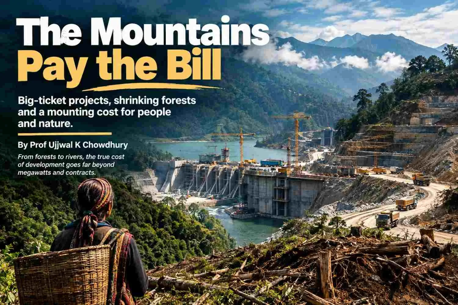
From the Aravallis to Arunachal, and from Great Nicobar to Ladakh, big-ticket projects are being advanced through a system that counts megawatts, ports and contracts more readily than forests, water, consent and risk, finds Prof Ujjwal K Chowdhury. SummaryIndia's development debate is often presented as a choice between jobs and conservation. The record of the last decade shows a more troubling question: who gets the contract, who gets the electricity or revenue, and who absorbs the costs when a forest, river or common land is changed beyond repair? Government data show 215,943 hectares of forestland approved for non-forest use between 2014-15 and 2025-26, with the annual pace rising sharply in the last two years. Court records, parliamentary reports and CAG audits document narrowed protections, unresolved consent, illegal extraction, project delays and steep cost overruns. These records do not prove one secret conspiracy behind every project. They do reveal an operating pattern: public authorities take ecological risks, communities lose the resources they depend on, and a concentrated circle of project developers and contractors receives the work. The counter-evidence is just as important: communities can restore water and livelihoods when they govern local commons. Development is not measured by the size of a project, but by whether it leaves people and landscapes more secure. A woman measures development in water In Shyampur, a village in Rajasthan's Karauli district, Anita gave rural journalist Bharat Dogra a measure of progress that no project appraisal can easily capture: the village began to move forward only after water scarcity eased. It is an ordinary sentence with a hard policy implication. Water is not a side benefit of development. It is the platform on which health, farming, livestock, education and income stand.[2] Dogra's account follows five decades of visiting drought-struck villages. In the Bundelkhand and Patha belt, he describes women carrying muddy water over long distances, cattle left behind when fodder and water ran out, and wells reduced to dangerous pits. He also records a different kind of infrastructure: Shyampur's 18 new water bodies and 14 restored ones, a de-silted tank, water-saving farming and village stewardship. Nearly three-quarters of cultivated land there was reported to have returned to productive use.[2] In one drought in the Patha plateau, Kol tribal women walked nearly five kilometres in the heat for two pitchers of unsafe water. Dogra's point is not nostalgia for village life. It is that a destroyed catchment can make even a newly installed tap unreliable, while watershed repair can restore water for people, farms, livestock, birds and wildlife at once.[2] That story sets the test for India's largest projects. A dam, mine, road or port may promise energy, trade or security. But if it degrades a village catchment, fragments a forest or removes access to grazing, fish and sacred places, it can subtract the foundations of everyday life while adding impressive figures to an investment deck. The ledger puts construction costs in bold type and ecological liabilities in small print. The clearance ledger is accelerating Official figures reported to Parliament show that 215,943 hectares of forestland were approved for non-forest use between 2014-15 and 2025-26. Nearly 62 per cent was cleared for mining, hydropower, irrigation and roads. The annual average rose from about 14,941 hectares in 2014-19 to 19,223 hectares in 2019-24. In 2024-25 and 2025-26 alone, approvals reached 45,125 hectares, or roughly 61 hectares each day.[9] These are approvals, not a measure of how much was actually felled; still, the direction and scale matter. A separate petition filed in the Delhi High Court alleges that the National Board for Wildlife's Standing Committee approved 97 per cent of 2,186 proposals between 2014 and 2026, involving at least 95,724 hectares. That is an allegation in a pending case, not a judicial finding. It raises a serious governance question all the same: if the body charged with scrutinising projects in wildlife landscapes almost never says no, what level of scrutiny is taking place?[4] The eastern Himalaya saw especially sharp increases. Arunachal Pradesh recorded 6,038 hectares of diversion in 2024-26, more than eight times its 2014-19 total; Sikkim's two-year total was nearly 19 times its earlier five-year total.[9] These are headwaters and steep slopes where floods, landslides and seismic hazards make mistakes unusually costly. A national average hides local concentration. Parcel-by-parcel clearances can miss the cumulative damage from roads, power lines, mines and reservoirs within one connected landscape. When the law moves the goalposts The Forest (Conservation) Amendment Act of 2023 narrowed the statutory coverage to land formally notified as forest or recorded in government records on or after 25 October 1980. It also exempts specified strategic and security projects near borders and in other areas. The government says the change clarifies coverage and facilitates national security infrastructure. PRS warns that previously recorded but unnotified forests, and some land converted before the 1996 Supreme Court ruling, could fall outside central approval.[10] The exemptions are substantial in a border state: strategic linear projects of national importance can qualify within 100 kilometres of an international border, Line of Control or Line of Actual Control; security infrastructure up to 10 hectares is also listed, along with certain projects up to five hectares in areas affected by left-wing extremism. The Act also expands activities that may proceed without central approval to include government zoos and safaris in forest areas outside protected areas, eco-tourism facilities, and specified surveys.[10] In February 2024 the Supreme Court directed governments to keep applying the broader definition from the 1996 Godavarman case while land identification proceeds. That interim order is a guardrail, not a final ruling on every challenge.[11] The episode shows how a law can narrow protection and leave litigation to prevent it vanishing before records are complete. The 2022 Forest (Conservation) Rules let forest approval run alongside other statutory processes, including recognition of rights under the Forest Rights Act. The government says no final diversion order or land handover can occur until rights are settled.[12] The concern is practical: central approval can give a project momentum before communities establish what they own, use or hold sacred. A right considered after in-principle approval is harder to exercise than one considered before the site and contracts are fixed. In September 2026, a parliamentary committee called unanimous Gram Sabha consent a major obstacle to hydropower and proposed a 70-75 per cent threshold. The Tribal Affairs Ministry replied that the Forest Rights Act contains no general clause requiring such consent for forest clearance. That reading has force: the Act's express consent provision is specific. It does not settle questions about rights recognition, clearance conditions or authority over community resources.[3] Niyamgiri remains the clearest example of a Gram Sabha deciding a rights question. In 2013 the Supreme Court held that village assemblies should determine whether mining affected the Dongria Kondh's religious and cultural rights. The assemblies rejected the mine; it did not proceed.[13] This is not a universal veto. It is a reminder that rights tied to one landscape cannot be averaged away by counting neighbouring villages. The Aravalli hills are disappearing twice First the hills disappear under mining; then they risk disappearing from the maps that define protection. In 2018, a Central Empowered Committee report found that 31 of 128 sampled hills in Rajasthan's Alwar district had vanished since 1967-68. The Supreme Court ordered the state to stop illegal mining in the affected area.[14] The CAG's audit shows the enforcement failure was systemic. Rajasthan recorded 48,486 illegal-mining cases from 2015-16 to 2019-20, with cases up 169 per cent by the final year. Satellite analysis found illegal mining in 122 test cases, covering 83.25 hectares. The audit also found irregularities at 81.68 per cent of selected weighbridges and Rs 13.99 crore in penalties not imposed for unauthorised extraction.[15] This does not prove a political conspiracy; it documents weak controls that let extraction outrun the rules. In 2025 the Supreme Court accepted a 100-metre elevation test for defining Aravalli hills. The Indian Express reported that the Forest Survey of India warned this could exclude nearly 90 per cent of the hills. The Court put the definition on hold and appointed a new expert panel. Its August 2026 report said the range cannot be mapped by elevation alone: forests, water systems, biodiversity, habitat links and livelihoods matter too. It sought until February 2027 to complete the review.[16][17] The Aravalli is a range, not isolated peaks. Its lower ridges help hold soil and channel water. Exclude that connective tissue and the landscape is fragmented on paper before a bulldozer arrives. Great Nicobar has no spare island The Union government presents Great Nicobar as a strategic port-led hub with a terminal, airport, township and power plant. The NGT record puts the project cost at about Rs 81,834 crore. The government has approved in principle diversion of 130.75 square kilometres of forest, saying 65.99 square kilometres will remain green with no tree felling and citing biodiversity plans and monitoring.[18][20] Those safeguards matter; so does the scale of change. Great Nicobar is not an interchangeable parcel in a tree-planting ledger. Its forests and coasts sustain the Shompen, a Particularly Vulnerable Tribal Group, and the Nicobarese, alongside endemic species and leatherback turtle nesting habitat. In 2024, experts told the National Commission for Scheduled Tribes that the developer's calculation of the tribal reserve remaining protected was flawed and that tribal views were ignored.[19] The government says it followed consultation and protection policies.[18] The dispute is about who defines protection and whether local accounts of risk shape the plan before it is locked in. The NGT upheld the clearance in February 2026, citing adequate safeguards and strategic importance. In May, the Calcutta High Court agreed to hear separate challenges to the forest-rights process.[20][32] The clearance has survived one environmental challenge; tribal-rights questions remain live. The NGT's 2026 order also points to conditions for leatherback turtles, Nicobar megapodes, saltwater crocodiles, robber crabs, macaques and endemic birds.[31] The issue is whether those conditions can manage a transformed landscape and cumulative pressure on forest, coast and community, not whether a clearance document lists protected species. Planting elsewhere cannot recreate a Nicobar rainforest, its species, coastal protection or the Shompen's cultural geography. Compensatory afforestation cannot make unlike ecosystems equivalent. In Arunachal the river is not vacant energy Arunachal Pradesh has declared 2025-35 its Decade of Hydropower, targeting 19,165 MW across 33 projects, against estimated potential above 50,000 MW.[23] The proposed Siang Upper Multipurpose Project is roughly 11,000-11,200 MW, with a dam up to 250 metres high. It remains at the survey stage; its final footprint and displacement list are not settled.[7][8] For Adi communities, the survey is not abstract: it is an official entry into ancestral land, farms, river and sacred geography. Residents from more than 27 villages oppose the project and surveys. Down To Earth reported that central armed forces were deployed in two districts in May 2025 to support the pre-feasibility survey. Villagers called the deployment coercive; authorities say the project is strategically important because of China's planned upstream dam.[24] The state government later said it would not rush the study and would hear affected families.[7] Consent requires a trusted process before equipment arrives. In September 2026, national environmental groups expressed solidarity with the Siang movement and said a CBI case under the FCRA against activist Bhanu Tatak formed part of a wider campaign to pressure dissent. That is the groups' allegation, not a court finding; it should be examined through due process.[6] A basin-wide assessment must account for sediment, fish, flood risk, seismic hazards, downstream communities and other proposed dams. A single-project study cannot show the cumulative effect on a river system. The Siang proposal is one part of that rush. The government's sectoral account also lists the 2,880 MW Dibang Multipurpose Project and 3,097 MW Etalin project in the Dibang basin.[23] The exact stage and footprint differ, but the combined scale makes basin-level assessment more important than any single project's clearance. Hydropower can be low-carbon at the point of generation and still impose high costs through forest loss, altered sediment, disrupted livelihoods and risk in a seismically active region. Subansiri Lower shows the financial risk. A parliamentary committee reported that the 2,000 MW NHPC project on the Assam-Arunachal border had risen from Rs 6,285 crore to an estimated Rs 27,949 crore, a 344.66 per cent increase.[25][26] Delays, disputes, redesign and disruption all contributed; no one cause explains the rise. The public purse carries the overrun while the valley carries the physical changes. Arunachal's revenue ambitions are real, as are India's power and security needs. But projected revenue is not realised benefit, and planned megawatts do not guarantee local prosperity. Affected people need enforceable benefit-sharing, independent safety review and a meaningful role before the dam becomes inevitable. The Western Ghats and the sunk-cost trap Karnataka's proposed 2,000 MW Sharavati pumped-storage project, estimated at Rs 10,240 crore, would require forest diversion inside the Lion-Tailed Macaque Sanctuary. In September 2026, Shankar Sharma reported that 142 hectares were at stake and a central expert committee had recommended against approval; the High Court stay ran through October 1. The committee cited tree felling, fragmentation and wildlife disturbance.[1][27] Sharma said RTI records showed seven project bills paid to an identified EPC contractor over about ten months before required clearances.[1] That is not proof of a bribe or corrupt award. It does show how public spending can become a sunk cost before an ecological decision is settled, making rejection politically harder. Proposals in the Varahi and Malaprabha catchments raise the same question: is each site necessary after comparing it with grid upgrades, demand management, battery storage and distributed systems? Batteries may not meet every long-duration need; alternatives should still be public and independently tested. The Varahi proposal alone is described as a 2,500 MW project in the catchment around Mookambika and Someshwara sanctuaries. A separate 1,600 MW Saundatti proposal would require forest diversion in the Malaprabha basin.[1] Their status is at the planning and tendering stage, not construction. That is precisely when a comparison of storage options, forest fragmentation and watershed impacts is least expensive to do and most useful to the public. On July 27, 2026, the Centre reissued a seventh draft to classify about 56,825 square kilometres across six states as ecologically sensitive. Previous drafts since 2014 did not produce a final settlement.[1] A region can be valuable enough to avoid casually clearing and still too politically contested to protect. Ladakh's fragile high country Strategic roads and mobile coverage serve Ladakh residents as well as defence personnel. The question is where and how they are built. In 2023 the State Board for Wildlife approved 25 projects in wildlife areas: 20 mobile towers, four security roads and a solar telescope on Pangong Lake's bank inside Changthang sanctuary.[21] The issue is whether separate permissions are assessed cumulatively. A peer-reviewed study of 24 Changthang wetlands found distance from roads and settlements strongly related to the abundance of several waterbird species.[22] This does not mean every road has the same effect. It does show that access and construction are ecological variables in a high-altitude wetland system. The cold desert supports black-necked cranes, kiang and migratory birds, and recovers slowly from disturbance. The black-necked crane is protected under Schedule I of the Wildlife (Protection) Act, and Changthang includes some of its important habitat.[22] This should prompt careful routing and seasonal controls, not a blanket refusal to serve remote settlements. The standard should be transparent mitigation with public monitoring after construction, not a one-time vote by the wildlife board followed by silence. A road may connect a hamlet to a clinic and open a wetland to traffic, tourism and waste. Planning must map breeding grounds, water sources and seasonal grazing, then track cumulative effects. The contractor is visible; the hidden costs are not The phrase 'politician-bureaucrat-contractor lobby' cannot replace evidence. The record does not prove one conspiracy behind every clearance, but it does show incentives. Appraisal is often file by file; a parliamentary review said hydropower relies on only four or five contractors and recommended expanding that base.[25] That is a concentrated market, not proof of collusion. The CAG found mismatches in Rajasthan's extraction and transit records, uncollected penalties, weak weighbridge controls and royalty revenue at risk.[15] Sharma's account of early contractor payments in the Western Ghats raises another accountability issue. Subansiri's cost rise shows how delays can shift costs to the public. Together, these records show activity outrunning financial and ecological controls, even if they do not prove every rupee became profit. One CAG finding was especially revealing: 13 mining leases showed no excavation, yet 5.2 lakh tonnes of mineral were recorded as dispatched using 22,854 electronic transit permits.[15] A well-run licensing and weighbridge system should make such discrepancies difficult. Where extraction proceeds and the state cannot reconcile the records or collect penalties, the gap is not a theoretical externality; it is a visible loss to the public purse and a possible gain to those moving the material. A contractor's work is measured in kilometres and bills. Lost commons are measured in less fodder, longer water walks, fewer fish or wetlands that no longer support birds. Land Conflict Watch maps about 1,095 conflicts; nearly 78 per cent involve commons.[28] Shared landscapes carry economic and cultural value that project appraisals routinely struggle to price. The Forest Survey of India's forest-cover measure includes land of at least one hectare with 10 per cent canopy, regardless of ownership or legal status, including plantations, orchards, bamboo and palms.[30] It measures canopy, not intact biodiversity. CAG audits have found weak monitoring, survival problems and gaps in identifying land for compensatory afforestation.[29] A new plantation may add cover without replacing an old forest's water regulation, soil, species or cultural role. The structural transfer is plain: project benefits are booked at the site and in revenue plans; losses are dispersed among villages, future generations and public budgets. Where rights are weak and ecological costs underpriced, profits can be private while risks are socialised. That is a defensible account of the lobby: not an accusation against every official or builder, but a system where a few decide and many live with the outcome. A different kind of infrastructure The 100 Stories of Commons archive documents communities protecting forests, wetlands, grazing land and village water bodies. It records not only what people lose but what they sustain.[5][28] Dogra's account of Shyampur belongs there, alongside Jal Sahelis who revive ponds and committees that maintain restored tanks.[2] These are not substitutes for every road or port; they show that public interest is not synonymous with scale. India needs energy, transport, flood protection and jobs. It also needs alternatives and community rights to shape projects before sites are fixed. Basin-wide studies should precede clearance. Publish appraisal minutes, forest maps, contractor awards and payments. Test the need against less damaging options. Recognise Gram Sabha rights before costs are sunk, and measure mitigation over time in the ecosystem being changed. For energy storage, that means comparing pumped storage with batteries, demand response, transmission and local storage against the actual duration and grid service required. For roads and security works, it means mapping the habitat first and publishing why a chosen route is necessary. For mines and ports, it means disclosing the full cost of water, restoration, carbon and community access, then auditing those promises after operations start. A mountain is not empty because a spreadsheet omits its streams or sacred paths. A forest is not replaceable because another state has space for saplings. Those facts belong on the first page of a project report, not the last page of a compensation plan. Anita's village rebuilt water bodies and made them work. From the Aravallis to Arunachal, ask before the next clearance: will this project make residents more secure, or will they pay for somebody else's idea of growth.  References: Inline bracketed numbers refer to the sources below. Government and court records are identified separately from reported analysis and advocacy claims. [1] Shankar Sharma, ‘Policy analyst urges PM, Environment Minister to halt ecologically destructive PSPs in Western Ghats,’ Counterview, 8 September 2026. [2] Bharat Dogra, ‘Where water changes lives: My fifty-year journey through thirsting villages,’ Counterview, 8 September 2026. [3] Palla Trinadha Rao, ‘Hydropower projects: How MoTA's one-page memo washes its hands of Gram Sabha consent,’ Counterview, 8 September 2026. [4] ‘Former bureaucrats question forest diversion and post-facto clearances,’ Counterview, 17 September 2026. [5] ‘Sustaining the shared: Lessons in resilience from India's 100 stories of commons,’ Counterview, 19 September 2026. [6] ‘Indigenous and environmental groups stand with Siang anti-dam struggle, raise FCRA concerns,’ Counterview, 22 September 2026. [7] Neha Desai, ‘The Siang divide: Development, indigenous rights and the fight over a mega dam,’ Counterview, 23 September 2026. [8] Lohit Sharma, ‘Submerging dissent: The true cost of Arunachal's hydropower rush,’ Counterview, 23 September 2026. [9] ‘India cleared 215,943 hectares of forest for non-forest use in 12 years,’ Down To Earth, 5 August 2026; analysis of official data reported to Parliament. [10] PRS Legislative Research, ‘The Forest (Conservation) Amendment Bill, 2023.’ [11] Supreme Court of India, interim order in W.P. (C) 1164/2023, 19 February 2024. [12] Ministry of Environment, Forest and Climate Change, ‘New Forest Conservation Rules, 2022,’ Press Information Bureau, 28 July 2022. [13] Supreme Court of India, Orissa Mining Corporation Ltd v. Ministry of Environment and Forests, 18 April 2013. [14] ‘31 hills vanish in Rajasthan's Aravalli region in 50 years: CEC report,’ Times of India, 23 October 2018. [15] Comptroller and Auditor General of India, Performance Audit on Illegal Mining in Rajasthan, Report No. 8 of 2022, Executive Summary. [16] Supreme Court of India, order in In Re: Definition of Aravalli Hills and Ranges, 29 December 2025. [17] The Indian Express, ‘Aravallis can't be defined by 1 yardstick: Supreme Court panel seeks extension,’ 4 September 2026. [18] Ministry of Environment, Forest and Climate Change, Great Nicobar project environmental-impact reply, Press Information Bureau, 2024. [19] Down To Earth, ‘Great Nicobar Project clearances violate constitutional mandate, views of tribals ignored: Experts write to NCST,’ 23 April 2024. [20] Hindustan Times, ‘No good ground to interfere in Great Nicobar Holistic Development Project: NGT,’ 16 February 2026; and The Indian Express, ‘Calcutta HC agrees to hear PILs challenging forest rights clearance for Great Nicobar project,’ 8 May 2026. [21] Administration of the Union Territory of Ladakh, ‘State Board of Wildlife gives clearance to 25 projects in wildlife areas of Ladakh,’ 2023. [22] ‘Influence of anthropogenic factors on the waterbirds in Trans-Himalayan wetlands,’ Global Ecology and Conservation, 2023. [23] Government of India, ‘Hydropower: Powering Arunachal Pradesh's Economic Future,’ MyGov, 2 June 2026; and Centre of Excellence for Himalayan Studies, Shiv Nadar University, ‘Local Response to National Projects: The Siang Hydropower Project in Arunachal Pradesh.’ [24] Down To Earth, ‘Survey tensions: Paramilitary enters Siang villages amid dam opposition,’ 22 May 2025. [25] PRS Legislative Research, ‘National Hydroelectric Power Corporation Limited,’ summary of Committee on Public Undertakings report, 6 August 2026. [26] The Tribune, ‘Parliamentary panel notes 345% cost overrun in NHPC's Subansiri project,’ 9 August 2026. [27] The New Indian Express, ‘Expert committee flags ecological risks, opposes Sharavathi project,’ 11 July 2026. [28] Land Conflict Watch and Common Ground Initiative, ‘100 Stories of Commons’ archive; database statistics accessed September 2026. [29] Comptroller and Auditor General of India, Performance Audit Report on Afforestation and Social Forestry Programme, Uttar Pradesh, Report No. 2 of 2024. [30] Forest Survey of India, India State of Forest Report 2023, methodology for forest-cover mapping. [31] The Indian Express, ‘NGT clears Great Nicobar project, cites adequate safeguards in environmental nod,’ February 2026. [32] The Indian Express, ‘Calcutta HC agrees to hear PILs challenging forest rights clearance for Great Nicobar project,’ 8 May 2026.   ...Read more

23 Sep 2026

Green labels and statements about being eco-friendly can be seen anywhere. But what if they are not as green as they claim? Explore this article to understand how environmentalism can be used as a marketing tool by companies and analyse how consumers are affected by such actions. Learn about greenwashing and how it can be avoided while shopping and how people are misled into buying products that are not worth the money. SummaryThis article discusses the concept of greenwashing and how companies are using terms like “eco-friendly” and “natural” to mislead consumers into buying their products. The article gives examples from various industries, such as food packaging, clothing, cosmetics, and hotels, showing how easy it is to confuse customers with false claims and images. It also looks at why greenwashing is on the rise in India, what companies, advertisers, influencers, and customers themselves should do to stop it, and what changes can be expected in 2024 – in particular, what new rules have been developed in India (CCPA) concerning “green advertising.” Introduction  Is Everything Green Really Green? Suppose we go to the store to buy a bottle of shampoo. We look at two similar ones, but the second one has pretty leaves and pictures of plants, and words like natural, eco-friendly, sustainable and earth friendly. Our unconscious brain at once tells us that the second possibility is better for the environment. But is it really? This is where the dubious concept of greenwashing comes into play. We live in an age where environmentalism has crossed the threshold from a niche to mainstream. Climate change, plastic waste, deforestation, carbon footprint, and sustainable living are now terms that are not only discussed by environmental activists, but also by the youth who are much more concerned with checking brands’ sustainability than before. As a result, many companies jumped on the bandwagon – realising that the modern customer wants to support those who care for the environment, and therefore, all products now seem to have a green label, use recycled paper for packaging, and mention something about preserving the earth in their marketing.  But What If the Greenest Choice Isn’t Actually Green? Think about the last time we tried to buy something that was better for the environment. We picked a bottle because it had “eco-friendly” written on it, chose a product with minimal-looking packaging, or noticed a clothing brand promoting a new “conscious” collection. At that moment, it feels like we are making the right choice. But then comes the question: how do we really know? Just because a product looks green, uses words like “natural” or “sustainable,” or talks about saving the planet, does that make it environmentally friendly? Most of us do not have the time to investigate every product we buy. We see the label, trust what the brand tells us, and move on. And that’s exactly where things can get complicated. Sometimes, the image of sustainability can be much bigger than the actual effort behind it. That is where greenwashing comes in. What Is Greenwashing? Greenwashing is when a company, product, or service is more environmentally friendly than it is. The term was first coined by environmentalist “Jay Westerveld” in the 1980s, when he noticed that many hotels were encouraging guests to reuse towels to save the environment – even though they continued to engage in other destructive behaviours. Since then, this concept has evolved and now covers a wide range of manipulative practices by businesses. For example, if a company produces a plastic bottle labeled as ‘made with natural materials,’ this can be considered greenwashing. Yes, if some of the components are natural, the statement is not false. However, it does not tell us which ones, which raises more questions than answers. Consequently, any product that has misleading environmental claims, vague statements, unsubstantiated information, questionable certificates, misleading comparisons, unproven sustainability, irrelevant environmental statements, or even an overestimated positive impact can be greenwashed. The main problem with greenwashing is that the appearance of environmental friendliness rarely correlates with reality.  Why Is Greenwashing Difficult to Spot in India? Greenwashing is not always as obvious as when a company is making a false claim. Sometimes it is hidden behind words that sound good but tell us little. Words such as “natural,” “eco-friendly,” “sustainable,” “green” and “conscious” have become so ubiquitous in advertising and packaging that the actual meaning could be lost in translation. In India, these green claims are found everywhere. They can be found on a supermarket shelf, clothing websites, food products, hotel websites, social media advertisements, and e-commerce platforms. While a product can write down that their packaging is recyclable, for example, it does not necessarily tell us anything about the actual product itself. This is where the confusion begins for an ordinary consumer who does not have the time or technical knowledge to figure out how a company arrived at their environmental claim. We see the packaging and stop for the day. That does not mean that every environmental claim is misleading. Some companies do indeed make efforts to cut down on their waste, use recycled materials, or lower emissions. We should focus on whether a claim is specific or has evidence behind it. Greenwashing should therefore not only be about green words but asking what is behind those words.  When One Green Word Hides a Bigger Picture One of the best ways to spot greenwashing is to look beyond one positive feature of a product. For example, imagine a product that writes down that their packaging is made from recycled plastic. This might be a positive and genuine environmental effort, but the claim does not write down that the entire product is sustainable. The same goes for clothing that is made from recycled or organic fibres or hotels promoting a “green stay” that has cut down their plastic bottle use.  While these are indeed positive steps, they are only certain aspects of a larger whole. Instead of asking “Is this product green?” we should be asking “Which aspect of this product or service is being highlighted as green?” This switch in perspective is key.  The Three Questions We Should Be Asking Before Believing a Green Claim Whenever we come across an environmental claim, we like to ask three simple questions that make it easier to process. What exactly is being claimed? Is the company saying that the product itself is sustainable, or only its packaging? Is “recyclable” referring to the entire product or just one part? Compared with what? A claim such as “uses less plastic” does not say anything about what it is being compared to. Less than the company’s earlier packing? Less than a conventional product? And by how much? Where is the evidence? This is the most important question for me. A claim should ideally have some form of supporting evidence such as a study, certification, data, or a clearly explained method of measurement. These are simple questions without the need to become an environmental scientist. These questions simply help us slow down before we accept a claim at face value. A green word is not evidence. The evidence is what makes the claim meaningful.  India’s Greenwashing Rulebook India has also begun to pay more attention to how environmental claims are communicated to a group of consumers. The Central Consumer Protection Authority (CCPA) introduced guidelines in 2024 specifically dealing with the prevention and regulation of greenwashing and misleading environmental claims. These guidelines are important because they reframe the conversation from simply using environmental words to explaining what those words actually mean. For instance, if a company uses terms such as “sustainable,” “natural,” “recyclable,” “carbon neutral” or similar environmental descriptions, consumers should be able to understand what the claim refers to. Environmental claims should not create a misleading impression through vague wording, incomplete information or visuals that suggest environmental benefits without proper explanation. The most useful way to look at this is through a simple chain: Claim → Evidence → Explanation First, what is the company claiming? Second, what evidence supports that claim? And third, has the company clearly explained the limitations or conditions behind it? This is important because the communication around environmental claims is no longer limited to traditional advertisements. The same claim can appear on a product label, Instagram post, website, marketplace listing or even inside a sustainability report. The responsibility therefore lies not only with consumers to question claims but also with companies to communicate them clearly.  The Boundary Problem Another important aspect of an environmental claim is its boundary. A product does not appear magically on a supermarket shelf. Its environmental impact can include several stages from sourcing raw materials, manufacturing and packaging to transportation, use and finally disposal. This becomes important when companies make claims about things such as carbon neutrality or recyclability. For example, saying that packaging is recyclable tells us something about the packaging. It does not necessarily mean that the entire product has a low environmental impact. Similarly, a carbon-related claim needs to explain what emissions have been included in the calculation and what method has been used. This is why the question “What does the claim cover?” becomes so important. Without knowing the boundary, a consumer may assume that a claim applies to the whole product when it applies to only one part of it.  From the Supermarket Shelf to the Shopping Cart Greenwashing is not only seen in big advertisements but can also appear in everyday situations. Imagine walking through a supermarket and seeing a product that is covered in green colours, leaves, and words such as “natural” or “eco-friendly.” Imagine shopping online and finding a product that is described as “sustainable” without much explanation. The same thing can happen while booking a hotel. A website may highlight an environmentally friendly initiative, such as reducing plastic bottles or encouraging guests to reuse towels. These actions may be genuine, but a consumer may still wonder what exactly makes the entire stay sustainable. The growing use of e-commerce makes this even more relevant. A product description can influence a buying decision just as much as physical packaging can. This means that checking environmental claims should not stop at advertisements. We should also take a closer look at packaging, websites, social media, product descriptions, and marketplace listings. The green message follows the consumer all the way from the advertisement to the shopping cart. India Under the Green Lens Looking at Indian examples makes the issue easier to understand because environmental claims are now becoming a part of many different industries. For instance, in the fashion industry, we increasingly come across terms such as “conscious,” “responsible,” “organic” and “recycled.” These terms can point towards genuine improvements, but we still need to understand what they refer to. If a garment is made using recycled fibres, for example, we know something about the material used, but we may not know about the environmental impact of its manufacturing, transportation, packaging, or disposal. Similarly, in the packaging sector, claims such as “100% recyclable” can sound quite straightforward. But when we look closer, recyclability can depend on the material, the design of the packaging and whether suitable collection and recycling facilities are available. The travel and hospitality sector gives us another example. Hotels and travel platforms increasingly talk about initiatives such as reducing plastic use, saving energy, or conserving water. These can certainly be useful steps, but we need to distinguish between one specific environmental initiative and a much broader claim about sustainability. These examples show us why the aim should not simply be to label a company as “good” or “bad.” Instead, we need to look at the specific claim, what it covers and what evidence supports it. After all, a company can make a genuine environmental improvement and still need to communicate that improvement more clearly. For us as consumers, understanding the difference is what makes it possible to make more informed choices. Who Is Responsible for Greenwashing? Well, this depends on who exactly we ask, but everyone plays their part in greenwashing, from big companies to social media influencers. Companies are naturally responsible for what they write on their product packaging and in their marketing materials. After all, they are the ones who decide what to write and what not to, and if they are intentionally exaggerating their sustainability, they should fix it. However, advertising agencies are also guilty because they are the ones who produce ideas and present them to the public. Meanwhile, influencers and celebrities should do more factchecking before posting a product that they position as eco-friendly. As for the consumer, we handle encouraging companies by buying their products. However, in my opinion, this is where the illusion ends. Because there is no motivation for companies to become genuinely sustainable — only to look good, gain points with customers, and increase sales through manipulative marketing. While it works fine on an emotional level, it does little to help the environment. Why Do Companies Greenwash? So, now we know what greenwashing is and how it works. But why do companies do it? Well, as I mentioned above, companies greenwash to increase sales, attract customers, and look good. But to understand why this happens, we need to look at the bigger picture: the fact that being sustainable is now cool and desirable, not only among the youth, but also among other companies. And the companies that want to compete in terms of sustainability have two options: to genuinely become sustainable and transparent or to resort to greenwashing to make themselves look better without really changing anything. In addition, companies often have an advantage over the competition if they mention sustainability in their marketing, since customers increasingly prefer to buy from organisations that care about the environment. Therefore, even if the company is only ‘a little bit green,’ it still has a good chance to attract customers who are just looking for eco-friendliness in the products. So, why not greenwash? When Did Greenwashing Become Such a Big Problem? Greenwashing has always been around and, unfortunately, it is not going anywhere. The reason for this is simple: companies want to be profitable and popular and therefore find ways to make themselves look better than they are. However, recently, this problem has grown significantly due to two reasons: social media and growing awareness of environmental problems. On the one hand, organisations now have more opportunities to promote their products and services, so they use them extensively to spread information about their ‘eco-friendliness.’On the other hand, people are now much more aware of environmental issues and therefore are better able to identify greenwashing. Consequently, it is now much easier for both companies and consumers to take part in and combat greenwashing. How Does Greenwashing Work? Greenwashing usually works by appealing to consumers’ emotions and presenting information in an attractive way rather than providing specific facts. The most common greenwashing techniques include vague language, green visuals, and misleading comparisons. For example, a company that wants to promote its new product as eco-friendly can do so by writing vague statements like ‘better for the planet.’ Better for whom? For what? There is no specific information – only general, unsubstantiated praise. Another example is using leaf-shaped logos, placing images of forests and fields on the packages, and other tricks to attract the attention of eco-conscious customers. Finally, many organisations try to hide the fact that they are not as sustainable as they would like us to believe by emphasising one positive trait (such as reforestation) while ignoring the rest (such as mass production). Thus, when evaluating an advertised product, it is essential to go beyond the superficial and analyse the facts carefully. Greenwashing in India India is home to hundreds of millions of consumers who are eager to keep up with the latest global trends. Sustainability is now a popular concept not only among environmental activists but also among the youth and influencers. Moreover, social media has made it much easier to spread information – so companies are now competing to be the first to introduce sustainable practices and label their products as eco-friendly. However, as in the rest of the world, this has led to the proliferation of greenwashing in India. On the one hand, this is logical: companies want to increase sales and profits, so they will do everything possible to attract the attention of customers. On the other hand, India is a huge market with many different players, so companies often resort to manipulation to stand out from the competition. Consequently, it is now becoming increasingly difficult for Indian consumers to distinguish between genuinely sustainable companies and those that only want to sell their products by labelling them as eco-friendly. Examples That Help Understanding Greenwashing Better Let us take a closer look at some simple but striking examples of greenwashing. Case 1: Eco-Friendly Bottle Suppose a company produces a bottle made of plastic and markets it as eco-friendly. However, they do not provide any specific information about what makes it sustainable. Meanwhile, we can assume that the bottle contains a certain amount of recycled material, the production of which is less harmful to the environment. If this is not mentioned, it may be an example of greenwashing. Case 2: Made with Natural Ingredients A cosmetic company markets one of its creams as 100% natural. This seems like a safe and eco-friendly choice. However, suppose our curiosity exceeds our trust in the company, and we start looking for information – and we find that the term ‘natural’ means nothing because no specific ingredients are shown. If so, it might be an example of greenwashing: not false advertising, per se, but a statement that is too vague to be considered reliable. How Can India Combat Greenwashing? India has long been taking steps to regulate advertising and hold companies accountable for false or unsubstantiated claims. For example, the Advertising Standards Council of India (ASCI) keeps a set of guidelines for advertisers that cover environmental advertising and prohibit deceptive practices. Meanwhile, the Central Consumer Protection Authority (CCPA) has issued guidelines banning false and deceptive advertising, including misleading environmental claims. Therefore, in India, we will not see unsubstantiated statements on product packaging, such as ‘100% natural’ or ‘eco-friendly’, because companies can be fined for making these claims without providing sufficient evidence. This is a step towards combating greenwashing, because now companies must be much more honest and specific in their statements. Conclusion: We Need Green Action, Not Green Advertising So, what can we take away from this discussion of greenwashing? The main idea is that while a company can look eco-friendly on the outside, it may be doing extraordinarily little to help the environment. Green labels on product packaging, eco-words in marketing, and statements about sustainability may seem nice, but they often conceal a lack of real action. However, it is important to understand that companies may resort to such tactics for many reasons some of which are completely honest. Therefore, instead of judging companies too harshly, we should encourage those who are genuinely striving for sustainability to improve and be transparent about their actions. We should support initiatives that have a real impact on the environment, such as reducing emissions or cutting down on plastic use, rather than rewarding vague statements with our money. In addition, I believe that regulators should continue to impose stricter regulations on those who resort to greenwashing and manipulate consumers. Remember that environmentalism should inspire us to do our part and when we interact with companies, we should ask ourselves what that part might be. We should not reward those who only want to make money by manipulating us and call out those who do not follow through on their promises. After all, the planet needs honest and transparent companies and so do we. References/ Sources : Department of Consumer Affairs, Government of India https://consumeraffairs.gov.in/ Advertising Standards Council of India (ASCI) https://www.ascionline.in/ United Nations Environment Programme (UNEP) https://www.unep.org/ Federal Trade Commission (FTC), United States https://www.ftc.gov/ ...Read more

21 Sep 2026

Summary: Charlands of West Bengal have blurred lines of identities, which state claims whom, which country claims whom is under constant change due to fluvial dynamics and ensuing riverbank erosion and flood deluge. Bhutni diara has been ravaged by the worst flood this year and this is the hour when we are left to think about another episode of blurred identity of lives and livelihoods.  Seated in dimly lit auditorium of Jadavpur University, I was greeted by the snap of a forlorn yet mighty Ganga River. The one who engulfs lands, devouring people of their lives and livelihoods and also gifts people a bounty of harvests too. She was flowing whispering about her people - the people with blurred identities, people of chars (islands) divided by rivers, also united by the rivers to share the same fate of deprivation and fight.  Deprived of the fertile agricultural land which used to feed the belly, there stands Rubel who is compelled to smuggle rice to Bangladesh. Rubel, who is entrusted with the responsibility of the entire family wants to continue school but cannot afford such luxury. Rivers change courses and with these capitals change like chessboard, lives and livelihoods are shaped, reshaped even obliterated.  Bhutni Diara: Sandwiched between two rivers with a weeping tale  Bhutni, part of the Manikchak Community Development Block is surrounded by rivers Ganga and Fulhar. This island falls in the physiographic subregion called Diara, which is a relatively well drained flat land formed by fluvial deposition of newer alluvium. The bank of the Ganges between Bhutni and Panchanandapur is the area worst hit by left bank erosion of river Ganga.  Bhutni diara, the largest of the three diaras of Maldah is situated near the point where river Ganga begins to bend south. The river also enters into Maldah district from this point. Ganga previously split into two streams here -  The eastern channel connecting the diara to Maldah mainland. This channel has gradually silted up becoming shallow and defunct. The western channel which is now the primary flow through the deeper channel.  Fulahar joins Ganga below the relict Mara Kosi, forming a spill channel that diverts excess floodwaters away from Ganga, towards Mahananda.  Retracing James Rennell's map shows that Ganges in the first half of the 19th century, after taking a round around Rajmahal hills, flowed past the island of Bhutni Diara, following the eastern channel resulting in considerable erosion on the Maldah bank.    Fig 1: Change of Bhutni char (prepared by author using SOI toposheet and Google Earth  Image)  Geological experts and local authorities are concerned about the impeding danger of flooding impacts which can extend beyond Maldah into South Bengal if a permanent river avulsion occurs due to merging of Ganga and Fulhar rivers.   Since 1922-23, bankline surveys and maps have indicated that Ganga has kept its course stable past the Maldah diara at two sites - Rajmahal and Farakka. Ganga has been scouring a deep path for itself along its left bank as it traverses the Maldah diara after passing the circular embankment protecting Bhutni. This has caused major left bank erosion in Manikchak and Kaliachak II blocks. The diara formations are built on a foundation of sandbanks overlain by colloidal silts and thus they are prone to saturation and bank failure, as the river scours away the base material at flood stage. The water levels regularly cross the Extreme Danger Level (EDL), with the Ganga peaking well over 25.64 meters during peak surges, turning the island into an open sea.  Bhutni: Abode of children of the Lesser God  Life at Bhutni revolves around the cultivation of jute (the golden fibre) but for families flooded every now and then, children turn out to be vital contributors from being mere spectators. By the time the children reach the age of five they become skilled in stripping and jute processing. Children here lack balanced nutrition. Balancing school and work becomes another issue of concern. During harvest, tuition classes are abandoned, school attendance becomes irregular.  However, parents need to rely on the income from jute cultivation for survival. Also prolonged immersion in stagnant water causes skin problems, injuries and other health risks.  If vulnerability among the dwellers by the riverbanks and char dwellers is gauged, char dwellers are found to be more vulnerable. Basic facilities are less accessible due to physical remoteness from the mainland. Facing both floods and riverbank erosion, char dwellers face more health vulnerabilities. Availability of food is another issue. Higher sensitivity for water is found among the char dwellers as most of them use hand pumps as a source of drinking water. Lower adaptive capacity is observed in case of char dwellers as they abound in dependent population more having to fight out inadequate access to financial and social institutions.  Bhutni, literally turned into open sea: 2026 flood  Bhutni char rose first to prominence from the riverbed around 1913 and since then has been losing itself to the erosive claws of rivers Ganga and Kosi, this year being the worst since 1998. 2,00,000 people are marooned across the 3 village panchayats of Bhutni - Uttar Chandipur, Dakshin Chandipur and Hiranandapur with more than 50 villages under water and thousands of families reduced to only the summis of the embankments and tiled roofs of the concrete houses still available.  Protective embankment at Kesarpur, built a year ago, costing over 6 crores, breached within months of construction - second major breach in the Bhutni ring bund since Mid August after an earlier rupture at Kata Dam in Dakshin Chandipur, this rupture led Fulhar gush in.  Photo plate 1: Flood and embankment breaching situation at Bhutni, 2026 (Source: News tap one and The Statesman)  A fresh embankment breach was observed on 2nd September. 3 high schools, 50 primary schools have got fully submerged alongwith Bhutni - Chandipur primary health centre and the local police station. 174 in patients had to be evacuated from the health centre. 5 schools have ceased to exist from Ratua I block, 3 more from Bhutni, 1 from Manikchak. Roadway connectivity to the main block of Manikchak has completely snapped, turning boats into the only viable mode of transport for relief, medical emergencies, and pregnant women. The situation has grown severe enough that the Indian Army (Panagarh unit) has been deployed to carry out mass deep-water rescue operations. Residents are surviving without cooked food, with dry ration which are being supplied by relief convoys.      Photo plate 2: Flood situation and relief convoys at Bhutni, 2026 (Source: Urban acres and Anandabazar)  Deaths due to snakebites and electric shocks were also reported. People of Bhutni are demanding a concrete solution to the repeated flooding and river bank erosion. However, any concrete solution awaits adequate comprehension of fluvial dynamics of the rivers surrounding Bhutni. Until then, let us strengthen the hands of the hapless people of Bhutni by adequate capacity building so that they are able to atleast cope up with the impeding danger lurking in the corner.  References:  Das R and Samanta G (2022): Impact of floods and river-bank erosion on the riverine people in Manikchak Block of Malda District, West Bengal Environment, Development and Sustainability, https://doi.org/10.1007/s10668-022-02648-1 Majumdar S, Das A and Mandal S (2020): Riverbank erosion and livelihood vulnerability of the local population at Manikchak block in West Bengal, India  Environment, Development and Sustainability, https://doi.org/10.1007/s10668-02102046-z  Bhaumik I and Upadhyay C.S. (2025): Little Hands in Golden Fibre: Childhood, Work and Hope in Bhutni Island Childhood matters Vol V(3) Char: A No Man’s Land documentary by Sourav Sarangi Char Gang ek Char by Md Sadequl Islam, Barnik Prakashani  ...Read more

21 Sep 2026

Christ’s Child: El Nino and Indian Monsoon examines how El Niño and the Indian Ocean Dipole can influence India’s monsoon, rainfall distribution and agricultural conditions, with particular attention to the uneven and delayed 2026 monsoon. SummaryThe article examines the relationship between El Niño and the Indian monsoon, beginning with the historical tendency for El Niño years to coincide with weaker monsoon rainfall in India. It explains how the Indian Ocean Dipole (IOD) can sometimes modify or counteract El Niño’s influence, making the relationship more complex than a simple cause-and-effect pattern. The article then looks closely at the 2026 monsoon, including its delayed progression, rainfall deficits, intense regional downpours, floods and landslides, and uneven distribution across different parts of the country. Particular attention is given to agriculture, where irregular rainfall affected Kharif sowing, paddy cultivation, irrigation costs and crops such as rice, pulses and oilseeds, with West Bengal also experiencing delays before later rainfall helped recovery in some areas. The article highlights the wider chain linking deficient or delayed monsoon conditions with lower agricultural productivity, rural income pressures, food prices and increased dependence on groundwater. It concludes by discussing practical responses including micro-irrigation, wetland restoration, groundwater recharge, improved drainage, crop diversification and shorter-duration, drought-resistant seed varieties to strengthen resilience against increasingly variable rainfall. World Meteorological Organizations (WMO) has assumed on the possibility of an El Nino episode that it may be bad news for the Indian Monsoon. Though experts’ opinion was it would be premature to say anything definitely at the juncture, an El Nino year usually negatively impacts rains during the monsoon.  On 10th March the India Meteorological Department (IMD) predicted that day temperatures are likely to remain above normal by 5 to 7°C over Jammu and Kashmir, Himachal Pradesh, by 4 to 6°C over places of North East India including Delhi NCR, Gujarat and Madhya Pradesh during few days in the month .  El Nino refers to the periodic large-scale warming of the ocean surface temperature in the central and eastern equatorial Pacific Ocean coupled with changes in the tropical atmosphere circulation including wind pressure and rainfall pattern (Vishwa Mohan, The Times of India, March 11, 2026).  The History:  Since 1980, there have been 14 El Nino years, 9 out of 14 have corresponded with deficient monsoon in India with rainfall at least 10% below the average. The year 2018 experienced deficit of rainfall at 9.4 %.  There is an established connection between the El Nino year and poor monsoon, though there have been exceptions. The notable example is 1997, when the monsoon was normal despite a super strong El Nino.  In 1997, a strong positive phase of the Indian Ocean Dipole (IOD), counteracted the El Nino. IOD is a measure of the temperature difference between surfaces in the ocean’s east and west regions. This year it is predicted that the IOD will probably be positive.        Fig 1: El Nino and Indian Ocean Dipole    IMD prediction:  June - September rains are likely to be below normal in South, Central and North West India. Monsoon onset over Kerala expected to be delayed. June is predicted to be hotter than normal.  On 30th June, 2026, IMD confirmed its forecast of below normal rainfall this year.  The 2026 monsoon in India experienced delayed onset and localised deficit, with IMD forecasting overall rainfall at 90% of the long period average.  March -May: pre monsoon showers were 1313mm nationally, close to the normal rainfall of 1306mm. Rainfall in the month of June experienced a deficit. June 2026 faced a slow start particularly across central and western states like Maharashtra and Gujarat due to delayed monsoon progression. August, 2026 experienced active spells targeting Kerala, Coastal Karnataka and south interior Karnataka with heavy to extremely heavy rainfall. Widespread rain is observed across Uttarakhand, Himachal Pradesh, Gangetic West Bengal and Odisha, though average rainfall is still below normal for several interior tract. Since July localised floods and landslides affected multiple regions in Himalayan region and North East India, mainly Assam caused more than 200 deaths. Uneven progression impacted Kharif crop sowing schedule. As a result, the cost of irrigation has created a problem. There is regional stress for major summer crops like rice, pulses, and oil seeds. Initial dry spells delayed paddy, coarse cereals and pulses planting in key rainfed areas, forcing contingency plans across nearly 200 vulnerable districts. There are also recovery signs during late July and August. Revival and localised heavy spells in late July and August have helped improve soil moisture and catch up on delayed sowing in several tracts, though regional anomalies persist. In the first week of August, 2026, heavy rainfall took place over Delhi, Haryana and eastern Rajasthan. But this heavy rainfall didn't reduce the overall country's deficits in rainfall. At least 11% deficit in rainfall will persist according to IMD. Many agrarian states of the country including Bihar, Jharkhand, Uttar Pradesh and Andhra Pradesh will continue to witness deficient rainfall affecting agricultural productivity (The Times of India, Kolkata, August 10, 2026) West Bengal: Erratic and delayed start across eastern India due to early El Nino impact led to a slow beginning for Kharif crop sowing in west Bengal. But July experienced deep depressions in the Bay of Bengal and subsequent heavy rainfall. This situation eliminated deficits enabling a steady recovery in paddy transplantation. June rainfall deficits and slow progression put initial stress on agricultural pockets postponing nursery bed preparation. Districts of South and West Bengal experienced weeks of delay in the standard Aman paddy schedule as farmers awaited proper soil saturation. During the early days of monsoon, the dry pockets of the state relied on ground water to protect seed beds. In another negative, it rained in many parts of the country at the time when the sowing of Kharif crops had ended in almost 88% of the country's total sown areas. Approximately 52% of the country's net sown area is rainfed and relies directly on monsoon rainfall. During 3 July to 31 July at least 34 places of the country experienced 200mm rainfall or more in 24 hours. Umargram of Bhaldas district of Gujarat experienced 1067mm rainfall on 23 July. It is the highest recorded rainfall in a day in 2026.  Umargram, Gujarat ------- 1067mm----2026  Sohora, Meghalaya ------1563.3mm--1995  Amin div, Laksha div----1168.5----------2004  In general, the rainfall scenario of the country is as follows,  Deficit rainfall in the first week of July,2002 amounting to 35%. On 9 July depression in the Bay of Bengal initiated rainfall throughout the country. July rainfall became normal after the first week. After the second week of July the deficit rainfall amounted to 51%. August,2026 closed out with a sharp 16% nation -wide rainfall deficit. August 2026 is registered as one of India's warmest August months since 1901. Isolated heavy to extremely heavy downpours over West Bengal, Jharkhand, and parts of Madhya Pradesh, while Punjab, West Rajasthan, and the southern peninsula remained largely dry. The first 9 days of September,2002, experienced a deep of 26% deficit affecting cotton, soybean and pulses production. Over 14 states and Union Territories report severe rainfall deficiencies. Heavily affected states include Andhra Pradesh and Punjab (40%), Goa, Kerala (24%), parts of Maharashtra (Vidarbha and Mararathwada), Karnataka, Rajasthan, and Gujarat (20%) Bihar (27%), Assam, Mizoram, Manipur, Arunachal Pradesh, Meghalaya and parts of East and North East India including some parts of West Bengal. The scenario may change as the withdrawal of monsoon is not complete. In the third and fourth week of September the rainfall pattern may change the scenario of the monsoon rainfall in 2026. There are areas of India with above normal rainfall during the 2026 monsoon although rainfall distribution is highly uneven. Gujarat and some parts of central India IMD recorded an isolated extremely heavy rainfall in Gujarat region and northern Madhya Pradesh on 13 September.  Delayed or deficient monsoon ----------- low agricultural productivity -------------low rural income --------------- increased food prices ------------- high dependence on ground water --------- ground water depletion.    The solution:  Micro -irrigation: deployment of Drip sprinkler irrigation can reduce water conservation by 30 -50% and enhance crop productivity. Restoration of wetlands:  Wetlands are the source of water during dry spells for preparation of paddy seed beds. Wetlands can reduce the possibility of flooding during heavy rainfall. Monitoring drainage infrastructure in flood prone urban areas. Strengthening ground water recharge systems to improve water management during extreme weather. Crop switching may take place. In rain deficit areas water -heavy paddy farming may be transformed into low -water, drought- resistant alternatives like millet and oilseeds. Short - duration seeds may be used in some water deficit parts of the country.  Quick yielding seed varieties that mature faster, allowing farmers to save their yield even within a compressed monsoon timeline should be taken into consideration.  ...Read more

16 Sep 2026

16 September 2026 | Kolkata Climate change is becoming a financial risk for Indian banks, not just an environmental concern. Heatwaves, floods, water stress and the shift towards a low-carbon economy can weaken borrowers, damage assets and affect loan repayments. The question is whether banks are identifying these risks early enough without making credit harder for smaller borrowers with limited capacity to adapt. SummaryA flood can damage property used as collateral, extreme heat can disrupt industrial production, and water stress can weaken the finances of water-intensive businesses. These effects can eventually reach a bank through weaker cash flows, repayment stress and potential losses. RBI's climate-risk work has already examined how physical and transition risks could affect banks, while highlighting significant data and modelling challenges. This article looks at how those risks move from the physical economy into credit decisions, collateral, insurance and provisioning. What happens when climate risk reaches a bank’s balance sheet? Climate change does not appear on a bank’s books simply as an environmental concern. It can enter through the borrowers, assets, cash flows and repayment capacity connected to the loans a bank has issued. A heatwave, for example, can disrupt industrial productivity or raise cooling costs. A flood can damage a factory, warehouse or residential property. Water shortages can interrupt production, increase operating expenses or reduce revenues. As these pressures build, businesses may face weaker cash flows and greater difficulty servicing their debt. For a bank, the chain can therefore be direct: Climate shock → disruption to business or assets → weaker cash flow → repayment stress → potential credit loss. Climate-related damage can also affect the value of collateral. If a property or industrial asset securing a loan is damaged, becomes less productive or loses market value, the bank may have less protection if the borrower eventually defaults. That is why climate exposure is not limited to loans labelled “green” or “sustainable.” A conventional loan to a factory, farm, housing project or small business can also carry climate-related financial risks if the borrower or the underlying asset is exposed to physical hazards or to changes brought about by the transition to a lower-carbon economy. For banks, the climate question is ultimately a financial one: how could environmental shocks change the ability of borrowers to repay and the value of the assets standing behind those loans? Climate Risk to Credit Risk HEAT / FLOOD / WATER STRESS / TRANSITION POLICY → Business or asset disruption→ Higher costs / lower revenue→ Weaker borrower cash flow→ Repayment stress→ Default / restructuring risk→ Bank credit loss / provisioning pressure Illustrative transmission pathway; actual impact varies by borrower, sector, location and scenario. How does a bank measure a risk that has not happened yet? Climate stress testing is a one-way, banks can try to answer this question. Rather than waiting for a climate-related disaster to expose financial losses, banks can test how their portfolios might respond under severe but plausible climate scenarios. The aim is to understand where borrowers, assets and repayment capacity could come under pressure before those risks materialise. In 2022, the RBI’s pilot Climate Vulnerability Assessment and Stress Testing exercise examined both physical risks, including floods and cyclones, and transition risks. Participating banks used information about their borrowers and collateral, along with vulnerability factors provided by the RBI, to estimate how climate scenarios could affect probabilities of default and potential credit losses. The results showed that climate scenarios could materially increase the potential for credit losses. The RBI reported a 66.1% increase against the baseline for flood risk and a 138% increase under a short-term tail-risk scenario. However, these figures need to be read carefully. They were scenario-based results, not forecasts of actual future losses. They indicate how losses could change under particular assumptions, rather than predicting exactly what will happen. That makes the assumptions behind a stress test as important as the final number. The choice of climate scenario, the vulnerability factors used, the exposure of borrowers and the value of collateral can all influence the outcome. A climate stress test, therefore, is not a prediction machine. It is a way of asking how resilient a bank’s balance sheet could be if climate risks become financial risks. RBI Climate Stress-Test Snapshot RBI PILOT CLIMATE VAST — 2022 15 banks assessed Physical-risk scenarios Flood: +66.1% credit-loss potential vs baselineCyclone: +65.8% Short-term tail-risk scenario: +138% Transition-risk scenarios Below 2°C:2030 +106% | 2040 +109% | 2050 +107% Divergent Net Zero:2030 +110% | 2040 +130% | 2050 +146% Scenario-based results from RBI's pilot exercise, not realised losses or forecasts. How much of the risk can banks actually see? This is one of the biggest challenges in assessing climate-related financial risk. Understanding climate exposure requires detailed information about where borrowers and collateral are located, what hazards they may face, how financially vulnerable they are and how well they can adapt. Without this information, a bank may know that an exposure exists without being able to accurately estimate how severe its financial impact could be. The RBI’s pilot exercise identified several information gaps, including difficulties with geographic data, forward-looking indicators, emissions data and information from counterparties. The central bank has also highlighted the uncertainty involved in modelling climate-related risks over longer time horizons. This creates an important distinction between known, estimated and unknown exposure. A bank may know its overall exposure to a particular sector or geography, for example, while having limited information about how individual borrowers within that exposure would perform under a specific climate scenario. The quality and availability of data can therefore directly affect how precisely the bank can assess potential losses. The challenge is not simply that some climate risks are difficult to predict. It is that some of the information needed to measure those risks may not yet exist, may be incomplete, or may not be comparable across borrowers. That information gap is itself a risk-management issue. If a bank cannot clearly see where its exposure lies or how vulnerable its borrowers and collateral may be, its ability to prepare for potential losses is also limited.  “KNOWN / ESTIMATED / UNKNOWN” KNOWN Disclosed sector exposureDisclosed geographic exposureReported climate scenarios ESTIMATED Future borrower vulnerabilityPotential collateral impactFuture transition costs UNKNOWN / NOT DISCLOSED Uninsured exposureClimate-linked default impactClimate-linked provisioningBorrower adaptation capacity Only classify information as “unknown” after it has been requested and not provided.What happens when climate damage affects collateral and insurance? For housing and other asset-backed lending, physical climate damage can create another layer of financial risk. A flood can damage a property that has been pledged as collateral for a loan. Damage to an industrial facility can reduce the value or usability of buildings, equipment and inventory. If the underlying asset loses value, the lender may also face greater exposure if the borrower struggles to repay. Insurance can absorb part of such a loss, but simply having an insurance policy does not tell the full story. For a lender, the key questions are: What is covered?How much is covered?Which risks are covered?What are the exclusions and deductibles?How quickly are claims settled?Who bears any uninsured loss? For climate-exposed lending, these details can significantly influence the actual protection available to both the bank and the borrower. The presence of insurance, therefore, should not be treated as proof that climate risk has been fully protected against. The real test is whether the coverage is adequate when the loss actually occurs.Where does provisioning fit in? If climate-related disruption increases the probability that a borrower will default, it can influence how banks assess expected losses and manage provisions against potential credit risks. But identifying exactly how much of a loss is caused by climate-related factors is not always straightforward. A borrower’s financial position can be affected by several pressures at the same time. Extreme weather may coincide with higher energy costs, weaker demand, supply-chain disruptions, regulatory changes and rising financing costs. Separating the impact of climate-related factors from these other drivers can therefore be difficult. The challenge is not simply to identify whether a loan is exposed to climate risk. It is to understand how climate factors interact with ordinary credit risk and how that interaction could affect the borrower’s ability to repay. This means banks need to look beyond simply attaching a “climate risk” label to a loan. The more important question is how climate-related pressures could change the underlying probability of default, expected loss and overall credit quality. Climate risk, in other words, is not a separate category sitting outside traditional banking risk. It can become part of the credit risk already sitting on a bank’s balance sheet.Is transition risk just as important as floods and heat? Not all climate-related financial risks come from physical events such as floods, heatwaves or cyclones. The transition towards a lower-carbon economy can create financial pressure of its own. Policy changes, shifts in technology, carbon-related costs, changing consumer demand and international trade measures can all affect businesses and the sectors in which banks have lent money. For a carbon-intensive borrower, these changes can reduce profitability, require additional capital expenditure or lower the value of existing assets. A business may therefore face financial pressure even without experiencing a direct physical climate disaster. CEEW’s work on transition-risk scenarios for India’s financial sector highlights the importance of adapting global climate scenarios to India’s own economic and financial conditions. This includes accounting for uncertainties around policy, technology, trade and the availability of climate finance. For banks, this means assessing two sides of the climate-risk equation: Physical risk: What happens if climate hazards become more severe and cause greater damage to businesses, assets and borrowers?Transition risk: What happens as the economy changes in response to climate policy, technology, markets and the shift towards lower-carbon activity? A bank that looks only at floods and heatwaves may therefore miss another source of financial stress: the economic transition itself.Physical Risk vs Transition Risk PHYSICAL RISKTRANSITION RISKHeatwavesPolicy changesFloodsCarbon costsWater stressTechnology shiftsCyclonesChanging demandAsset damageTrade measuresProduction disruptionStranded assets Both can create:Cash-flow pressure → Credit riskCould climate-risk pricing make credit harder for smaller borrowers? This is where climate-risk management intersects with financial inclusion. Large companies often have greater resources to invest in cooling systems, flood protection, water efficiency, insurance and business continuity measures. Smaller businesses, however, may have far less financial capacity to adapt to climate-related disruptions. If banks simply classify climate-exposed borrowers as higher-risk customers, some vulnerable businesses could face tighter lending conditions precisely when they need access to capital to strengthen their resilience. That does not mean climate exposure should be ignored. Instead, banks need to distinguish between exposure and resilience. A borrower operating in a high-risk area but making credible investments in adaptation may present a very different financial risk from a borrower facing similar exposure with little capacity to prepare or respond. The objective, therefore, should not be to withdraw finance from vulnerable sectors or locations. It should be to identify climate-related risks early enough to manage them while continuing to support borrowers in building greater resilience. What should banks disclose? RBI's climate-related financial-risk work has focused on areas including governance, strategy, risk management, metrics and targets, alongside the need for better and more granular data. For lenders, meaningful disclosure should help answer practical questions: Where is the exposure? Which sectors and locations are most vulnerable? What scenarios were tested? What time horizon was used? How much of the exposure is insured? How could collateral values change? What happens to defaults and provisioning under stress? What adaptation measures are borrowers taking? And, importantly: What information remains unavailable? Bank Climate-Risk Dashboard PHYSICAL EXPOSURE •    Flood•    Heat•    Water TRANSITION EXPOSURE •    Carbon-intensive sectors•    Policy sensitivity•    Technology risk FINANCIAL EXPOSURE •    Loan exposure•    Sector concentration•    Geographic concentration PROTECTION •    Insurance•    Adaptation spending•    Restructuring options FINANCIAL CONSEQUENCE •    Default risk•    Collateral risk•    Provisioning DATA STATUS •    Known•    Estimated•    Unknown Populate only with verified bank data. Where does this leave Indian banks? India’s financial system is developing the tools needed to understand climate-related financial risk, but significant challenges remain in measuring that risk accurately. RBI’s pilot exercise showed that climate scenarios can materially affect potential credit losses while also highlighting gaps in data availability and climate-risk modelling. The next step is to move beyond broad recognition of climate risk towards a more granular understanding of which borrowers, sectors and assets are exposed, how vulnerable they are, and what that exposure could mean financially. This requires climate risk to move beyond sustainability teams and become part of mainstream credit assessment, risk management and financial decision-making. Ultimately, the challenge for Indian banks is not simply to recognise that climate change creates financial risk, but to understand where that risk sits, how large it could become, and how early it can be managed.  The real test: Can banks price climate risk without pricing people out? Climate risk can enter the financial system through several interconnected routes. Flood → damaged collateral. Heat → disrupted production. Water stress → higher operating costs. Transition policy → higher costs or changing asset values. The financial consequences may eventually appear as weaker cash flows, loan restructuring, defaults or greater provisioning pressure. But managing these risks should not simply mean avoiding every borrower, sector or location exposed to climate hazards. That approach could protect a bank’s balance sheet in the short term while making access to finance harder for the very businesses and communities that need capital to adapt. Banks therefore need to understand the nature of the exposure, identify areas of uncertainty, assess the borrower’s resilience and support credible adaptation where it is financially viable. The most useful climate-risk assessment may ultimately be one that clearly separates what is known, what is estimated and what remains unknown. This distinction matters because climate-risk decisions are only as reliable as the information and assumptions behind them. For Indian banking, the challenge is no longer simply recognising climate change as a financial risk. The real challenge is to determine where that risk sits, how large it could become, who ultimately carries it and what can be done before it turns into a balance-sheet problem. And that is where climate-risk management must go beyond risk avoidance. The goal should not be to price vulnerable people out of finance, but to price risk accurately enough to manage it while keeping viable borrowers within the financial system. Sources: Reserve Bank of India — Climate Stress Testing and Scenario Analysis: Navigating Uncharted WatersPrimary source for RBI's 2022 Climate Vulnerability Assessment and Stress Testing exercise, physical and transition-risk scenarios, results, methodology and data challenges.RBI Climate Stress Testing and Scenario AnalysisReserve Bank of India — Report on Climate Risk and Financial StabilitySupports the discussion of physical and transition risks, climate-related financial stability and stress testing.RBI Climate Risk and Financial Stability materialReserve Bank of India — Climate-related Financial Risk DisclosuresSupports the discussion of governance, strategy, risk management, metrics, targets and climate-risk data requirements.RBI Climate-related Financial Risk Disclosure FrameworkCEEW — Transition Risk Scenarios for India's Financial SectorSupports the discussion of transition-risk scenarios and India-specific financial-sector climate modelling.CEEW Transition Risk Scenarios for India's Financial SectorIRDAI — Insurance Regulatory MaterialTo support insurance coverage, claims, exclusions and disaster-related insurance analysis once the specific case/borrower is established.IRDAI Regulatory Material ...Read more

16 Sep 2026

SummaryA long-drawn debate still goes on regarding the erosive nature of Indian Sundarbans, precisely the Gangasagar Island. Highly revered for the cultural significance of Sagar mela at makar Sankranti, this island draws its significance from the confluence of main flow of river Ganga through its medieval channel of Adi Ganga with the Bay of Bengal. In the Anthropocene when climate change and sea level rise are gnawing at the spine, what makes Gangasagar Island increasingly vulnerable is the galaxy of geomorphic factors and anthropic interference which play their roles in shaping the erosion accretion pattern of the island.   Highly acclaimed for the world famous Gangasagar mela at Kapil Muni ashram, every year, Gangasagar Island is one of the most vulnerable islands of Indian Sundarban. Located at a distance of 100 km from Kolkata at the confluence of rivers Bhagirathi and Hugli, this island is approximately 30 km in north-south extent and 12 km in east-west.   Premature reclamation was done in Sagar Island like the rest of Sundarban, by embanking the coastline and major tidal channels, completely blocking the smaller tidal creeks followed by deforestation. Sagar Island has been in news owing to continuous coastal erosion, which has compelled to shift the Kapil Muni temple. Most experts have shifted the blame to climate change, ensuing sea level rise (terms which are sure to capture attention within a blink of the eye). Nevertheless, geomorphic uniqueness of Ganga-Brahmaputra delta, Sundarban and the continuous in equilibrium caused by anthropic interference play their roles in carving the erosion-accretion pattern. Reclamation by preventing the tidal spill area also results in loss of morphologic equilibrium. As Hugli estuary is a macrotidal resonant estuary, loss of tidal spill area results in disequilibrium by reducing the intertidal area and increasing the mean depth of the estuary. The estuary then tries to restore the equilibrium by active erosion of embanked channel margins and by in channel sedimentation which reduces the depth (Pethick, 1994).  Erosion accretion scenario of Gangasagar Island:  The progradation and retrogradation of any delta is determined by the occupance and abandonment of the distributary channels. The relative dominance of erosive wave and tidal action and accreting fluvial forces demarcates the stability of the delta. The Ganga Brahmaputra delta is tide dominated and the western part of the delta of which Indian Sundarban is a part, is retrograding in nature due to various factors. The silt trapping ‘Swatch of No Ground’ submarine canyon, subsidence of Bangladesh side due to neo-tectonic movements causing the major flow of river Ganga towards Padma, siltation of the offtake points of river Ganga with its distributaries and sediment trapping by construction of barrages and dams in the upstream by humans have contributed to sediment starvation causing retrogradation of Western Ganga Brahmaputra delta.  Both erosion and accretion can be found sporadically with erosion being the main characteristic. The northern part of Gangasagar Island was observed to be detached from the islet of Ghoramara episodically between 1903-19014. The time span of 1922-1997 saw maximum erosion at Shibpur-Boatkhali area with recession rates as high as 23.8 m/y with 6 m frontal dune and series of embankments being obliterated (Bandyopadhyay, 1997). Erosion at Gangasagar Island has been so frequent that the Kapil Muni temple a shrine of great cultural significance had to be shifted about six times since it was built. The earliest recorded temple (Anon, 1841; Wilson, 1846) was submerged in mid-19th century. A number of temporary temples were constructed subsequently (O Malley, 1914; Mitra, 1954; Ray, 1971). Though a permanent building was constructed in the year 1961 but it too got eroded. The present temple was constructed in 1973, some 1.5 km inside the spring tide line (Bandyopadhyay, 1997).  Interestingly, an erosion accretion cycle got superposed over the dominant erosive pattern at the southern sector between Gangasagar and Basantapur since 1922-23. This region retrograded during 1922- 1942, prograded during 1942-1969, retrograded again during 196869 – 1975 and was almost stable during 1975-1997. Small islands in the Baratala branch to the east of Sagar Island grew and disappeared bearing testimony to the ephemeral nature of Hugli estuary. A fusion of Kabasgadi Island to the left bank of the estuary between 1967-68 and 2001 was observed. The widening of the Baratala river throughout previous 200 years remarked that Sagar was attached to the area to its east sometimes in the past (Bandyopadhyay, 2000). Long term oscillations in the thalweg of Hugli are observed and changes in the islands of Hugli estuary are linked to the changes in its tidal channels and sand ridges. Reworking of sediments by wave action plays an important role in regulating the ephemeral nature of islands in Hugli estuary. Moreover, the islands are characterized by cyclical patterns of erosion and accretion and this strongly discards the model of sea level rise.  Even in the 80s, Muriganga river was accessible, better than the present times. Vessels used to ply regularly from Lot no 8 of Kakdwip to Kochuberia of Gangasagar Island. The journey was hassle free unlike today when vessel service needs to be kept closed for at least 5 hours daily as there is a risk of getting obstructed by bars. Even the coastline was different; one had to walk for about 2 km crossing sandy path. The sandy beach was interspersed with runnels (depressed areas filled with clay) and beach berms (sand dunes). One had to cross a tidal creek to reach Beguakhali to the east from Gangasagar. This path was laden with mangrove patch. A lighthouse was present even then about 500 m from sea. High sand dunes were present in Tapovan area. Concrete embankment which was created in 2022 March breached within September 2022. Even high concrete embankments broke down during cyclone Sitrang of 2023.     Fig 1: Erosion accretion scenario of Gangasagar Island  Previously, during the 80s, Gangasagar creek was surrounded by mangrove patch and to its east, a sand ridge used to block the creek perpendicularly. At some places these sand ridges were 30-40 feet high. Even sand encroachment at Raspur, Basantapur villages were observed previously. Even past remnants of zamindari embankments used to get exposed in these areas along with exposure of tree trunks.  This bears testimony to the fact that there was a forested stretch to the southern portion of these settlements. For the previous 30 years, these areas have been experiencing beach lowering.   Gangasagar Island has lost about 12.982 km2 and gained about 10.244 km2 within 1968 and 2021. Erosion persists more in the north east and south east portions adjacent to Kochuberia, Haradhanpur, Dhablat and Beguakhali to the west.  SL NO ISLAND UNITS     Area (km2)     1920 1968 1978 1988 2006 2019 2021 2023 2025 1 G Plot 57.2 55.7 51.9 50.4 42.4 41.8 41.6 41.8 41.2 2 Mousuni 30.6 30.2 33.3 27.6 29.4 28.1 27 26.7 25.8 3 Sagar  242.9 258.8 248 253.4 236.8 240.2 235.7 231.5 4 Namkhana 154.4 157.4 155.3 156.4 151.9 145.3 147.7 147.1 146.2  Displacement of residents from Ghoramara and conflict:  People of Lohachara and Khashimara (Ghoramara) have been rehabilitated at Dhablat, where at present 267 families reside. Presently, agriculture relies on paddy and khesari (pulses). Freshwater supply has resulted in cultivation of Aman paddy and potatoes in the winter. Watermelon is no longer profitable. Also, people of Lohachara have bought land at Kakdwip. Literacy is high in Gangasagar Island but outmigration is common among the young generation.   Connectivity has increased at Gangasagar Island, which is a sign of development according to the local residents. All small and big tourist resorts, even the government bungalows get filled during Gangasagar Mela. Erosion has increased in the past 4-5 years. People demand concrete Aila bandh (15 ft deep) to be constructed in front of Kapil Muni temple. Gunny bags are provided to protect the area adjacent to Kapil Muni temple just before Gangasagar mela.  Displaced to Displaced from Year Brief description Phuldubi             (80-85 families) Khashimara, Ghoramara 1964 Each family was given 0.533 ha of land from the Government Dakshin Haradhanpur (50                    families approximately) Khasimara 1964 Each family was given 0.533 ha of land from the Government Bankimnagar Lohachara 1972 Each family was given 0.883 ha of land from the Government. Bankimnagar Colony Fisherman Cooperative Society was established. Gangasagar Colony Ghoramara 1981 Each family was given 0.267 ha of land from the Government and one room earthen house was given. Jibantala Kamalpur Lohachara, Ghoramara 1983 Each family was provided with asbestos roof pucca house and 0.2 ha land.      Plate 2: In front of Kapil Muni Temple, 2026 (Photo credit: Dr Kanailal Das)  It is thus of no doubt that Kapil Muni temple awaits yet another shift. However, the timeline may be disputed upon. Wave dashing engulfs the sea facing islands and Gangasagar Island is no exception in this case. Options like offshore breakwater and artificial coral reefs have been thought about but these options are not only exorbitant but also are sure to cause other knock on effects on the natural systems operating here.   References:  Bandyopadhyay S. (1997): Coastal erosion and its management in Sagar Island, South 24 Parganas, West Bengal Indian JournalEarth Sci. 24(3-4) 51-69 https://doi.org/10.5281/zenodo.7264120. Bandyopadhyay S. (2000): Coastal changes in the perspective of long term evolution of an estuary: Hugli, West Bengal, India, Proc. Int. Quat. Seminar on INQUA shoreline, Indian Ocean Sub-Commission: 103-115.  Bandyopadhyay S. and Bandyopadhyay M. K. (1996): Retrogradation of the western Ganga-delta, India and Bangladesh, Possible reasons. In. Tiwary, R.C. (ed.), Proceedings of 6th conference of Indian Institute of Geomorphologists, National Geographer, 31(1&2): 105-128. Bandyopadhyay S., Kar N.S., Dasgupta S., Mukherjee D. and Das A. (2023): Island area changes in the sundarban region of the abandoned western ganga–brahmaputra– meghna delta, India and Bangladesh, Geomorphology 422 (2023) 108482, https://doi.org/10.1016/j.geomorph.2022.108482. Mitra R (2013): Need of a paradigm shift in disaster management approach: A case study from coastal Sundarbans presented in 7th Biennial Conference Indian Society for Ecoloical Economics (INSEE) Global Change, Ecosystem Sustainability. O Malley’ L.S.S. (1914): Bengal District Gazetteers: 24 Parganas (Bengal Secretariat Book Depot, Calcutta) 1914. Paul A. K. (2002): Coastal geomorphology and environment published by acb publications. Paul A.K. (1991): Effective management strategies for the coast of West Bengal J. Geogr. Rev. India 53, pp 60-74. Pethick J (1994): Estuaries and Wetlands: Function and form In Wetland Management, edited by Falconer, R.A. and Goodwin P (Thomas Tetford), London 1994, pp 75-142. Ray A.K. (1971): The Gangasagar Fair (In Bengali), In Mitra, A. Ed. Religious Festivals and Fairs of West Bengal in Bengali, 3 (24 Parganas district), Govt of India (Census Operations), New Delhi, 255-271.   ...Read more

14 Sep 2026

A deeply personal journey through the Indian Sundarbans, where grief becomes responsibility and memory becomes action. Prof Ujjwal K Chowdhury reflects on education, climate vulnerability, mangrove protection, safer livelihoods and community resilience—arguing that the future of the delta depends not on sympathy alone, but on giving its people the power to remain, rebuild and thrive. SummaryThe article traces a deeply personal journey through the Indian Sundarbans, where memory, grief and responsibility gradually become inseparable from questions of education, climate resilience and community survival. It moves from early encounters with village life to the experience of a cyclone-damaged school, showing how environmental destruction is felt through lost learning, insecure livelihoods, migration and social vulnerability. The piece argues that schools in the Sundarbans must become centres of resilience, equipping children with ecological awareness, disaster preparedness, digital confidence and practical skills rooted in local realities. It also examines mangrove restoration, blue-carbon possibilities, responsible tourism, safer livelihoods and anti-trafficking efforts as interconnected parts of protecting the delta. Throughout, the article insists that the people of the Sundarbans should not be reduced to symbols of suffering, but recognised as active participants in shaping their own future. Its central message is that the region’s survival will depend on turning emotion into sustained solidarity, stronger institutions and practical action that allows communities to remain, rebuild and thrive. A first person journey through memory grief and hope in the Indian Sundarbans Before the Delta I Learned to Listen I grew up between two very different landscapes, and both taught me to listen. I studied in the Ramakrishna Mission at Aalo and later at Narendrapur until I attained adulthood. Those years gave me an education in discipline, simplicity and service. They also left me with a quiet unease about suffering that people learn to accept as normal. I did not have the language for it then. I only knew that a child who had less was not worth less.At Jadavpur University, while pursuing my Master's in International Relations, another education began. The campus opened the door to social realities and to the politics of socialism and social justice. Poverty was no longer a distant picture or a line in a textbook. It had history, power and policy behind it. I began to ask why some children inherit choices while others inherit only risks, why a village is praised for its resilience when it has first been denied safety, and why the poor are so often expected to adjust to conditions that the privileged would never accept.That education did not make me an expert on other people's lives. It made it more difficult for me to look away. The values I had absorbed at Aalo and Narendrapur met the questions I encountered at Jadavpur, and together they shaped a way of seeing. Service could not mean standing outside a community with answers. Social justice had to begin with listening to people who had been living with the problem long before the city discovered it. 1988 I Entered Through a Wedding My first visit to the Sundarbans was in 1988, when I was studying for my Master's in International Relations at Jadavpur University. I did not go in search of a landscape to describe, a report to write or a cause to claim. I went because Geetadi, the rural woman who had cared for me when I was a young man living alone, invited me to her daughter's wedding in a village near Lakhsmikantapur. I went as someone who had been invited into a family, not as a benefactor or a guest of honour.The city gradually dissolved into fields, narrow roads, river crossings and the smell of wet earth. In that village, life moved to another rhythm - slower perhaps, but also harder and more dependent on one another. The wedding was held together by many hands. Neighbours cooked, men arranged chairs, women sang, and children ran barefoot through the afternoon. Poverty was visible, but so was a social wealth that Kolkata often conceals: the assurance that, in a difficult hour, somebody will come and stand beside you.I remember eating a simple meal and feeling richer than I had at many city dinners. The rice was ordinary. The generosity was not. I was meeting the Indian edge of the world's largest delta through a human invitation, and that first welcome has remained with me. Even now, I understand the Sundarbans through people before postcards, through the hands that cook, row, teach, repair and endure. The Delta Stayed With Me I returned many times after that first journey. The number may now be more than fifty, but counting visits does not explain what the place has done to me. Each journey altered the picture I had carried back from the previous one. The Sundarbans was never only the forest, never only the tiger, the river or the tide. It was a mother waiting for news of a boat, a child trying to keep a notebook dry, a teacher opening a classroom after a storm, a family rebuilding a wall before it had recovered from the last one.There is a word for the feeling that makes another person's suffering impossible to treat as somebody else's problem: pathos. It is often described as an appeal to emotion, but in the Sundarbans I have understood it as something more demanding than sentiment. It is the moment when a damaged roof becomes a child's lost school day, when a saline pond becomes a family's shrinking food supply, and when a mangrove becomes the thin living line between a home and the sea. Feeling becomes an obligation to know, and knowing becomes a responsibility to act with humility.That emotional connection is a large part of how I came to own up to my responsibility toward the Sundarbans. I do not own the land. I do not speak for its people. The place slowly entered my moral geography, and its pain began to feel personal without ever becoming mine to possess. My background, my teachers and my education had prepared me to recognise an injustice. The people of the delta taught me that recognition is only the beginning. The Day Maa Said Okay Years later, during the strange half-opening of India after the first lockdown, I asked my mother if she would come with me to a school in the Sundarbans. She had been confined at home for months. I promised a careful drive, no crowds and a slow return. I told her she would see water, forest land and Sundari trees. She listened and said, simply, 'Okay. Let us go.' I did not know that this small consent would become one of the most important sentences of my life.On November 1, 2020, Maa sat in the back seat wrapped in a shawl. She told me to drive slowly and not overtake. 'This is not the time to prove anything,' she said. I still hear her voice when I am impatient. As Kolkata fell behind us, the sky widened. Buildings gave way to fields, water and the long, patient green of Bengal. The Sundarbans seemed to exist halfway between soil and river, with the borders between land and water forever being redrawn.The school did not look like a school when we arrived. Cyclone Amphan had torn away part of the asbestos roof, and the pandemic had emptied the classrooms. There were no children, no laughter and no roll call. Yet a few stubborn people were refusing to let the school die. Jaikrishna Haldar, its founder, spoke quietly: 'This school will start again.' He sounded like a caretaker refusing to abandon a child.Maa walked through the broken corridors and asked how long the school had been shut. 'Since COVID,' I said. 'And Amphan finished what COVID started.' She nodded. Then she gave the tragedy its most exact description: 'Children will suffer quietly. Adults will pretend they do not know.' The sentence has stayed with me because it did not ask for pity. It asked adults to accept responsibility.Next to the school was a small manmade mini Sundarban - six ponds, trees, mangroves and Sundari plants, protected through community labour. Maa touched the leaves, plucked a little flower and smiled. I took a photograph of her in the sunlight, calm and alive. When I look at it now, I see more than a mother enjoying a day outside. I see the last full journey I made with her. We returned to Kolkata, fell ill with COVID, and on November 24 she was gone. A Dying Wish From Maa Became a Promise Before she was taken to hospital, Maa gave me five wishes: travel more, complete my work, look after my health, do not grow old in loneliness, and do something for the school we had just visited. The last wish was spoken without drama. That was its power. A mother who had spent her life caring for others was placing one small unfinished responsibility in my hands.On her first death anniversary in November 2021, I returned to the Sundarbans. I invited nearly five hundred villagers to a feast in her memory. We ate, remembered and allowed grief to become communal. Women served rice with practised generosity. Children ran barefoot between the adults, carrying on with the authority of life. They did not know that, for me, every face in that gathering was part of Maa's final instruction.Out of that grief came the Smt Anu Chowdhury Memorial Educational Foundation. We adopted Vivekananda Adarsha Vidyalaya, run by Vivekananda Sangha in Sankijaan village in the Kultali police station area. The school did not become a monument to my mother, and certainly not to me. It remained what it had always been: a village's claim to its children. The work began with listening to teachers, families and students, and with accepting that a damaged school needs continuity more than ceremony.A school bell in a village announces something larger than the beginning of a class. It says that the children are still here, that learning has not been washed away, and that their future will not be surrendered quietly to poverty, storms or migration. The promise I made after Maa's death has meaning only when the school becomes stronger in the hands of the community. A School Is a Living Ecology At Kultali, I have slowly learned that grassroots education cannot be separated from the ecology and economy around it. A child who learns about water should be able to understand the salinity of the family pond. A child who studies the weather should know what a cyclone warning means. A child who learns digital skills should also know how to use digital finance safely. A young person who loves the mangrove should be able to imagine a livelihood that does not require abandoning home in desperation.The education we are trying to support is therefore holistic and rooted in place. It combines foundational learning with respect for the local language and culture, ecology, arts, sports, digital exposure, community learning and everyday sustainability. It is value-based without being moralising, nature-based without becoming a field trip, and participative enough for a child to ask questions that an adult may not have anticipated. The aim is not to burden children with every problem of the delta. It is to give them knowledge, confidence and choices.Teachers carry much of this work. They need training, professional dignity and the freedom to help children learn beyond memorised answers. A school cannot become resilient if its teachers are left alone after every cyclone to reconstruct both the roof and the learning process. The community, too, must see the school as its own institution. Parents who fish, cultivate land, work as agricultural labourers or migrate for income carry knowledge that belongs in a child's education.The work is now gradually extending from Kultali towards Jhorkhali and Sagardweep, where two more schools are being supported in the process. This is a small beginning, and it remains unfinished. But its direction matters. The purpose is to build a connected culture of learning in which children in different corners of the delta can study, create, stay safer and see dignity in their own surroundings. The expansion is not about spreading a name. It is about widening the circle of children who are allowed to imagine a future. A Delta Negotiating With the Future When I return now, I cannot see the Sundarbans only as beauty. I see a place negotiating with the future every day. The danger is not one dramatic morning when the ocean swallows everything at once. It is the slow loss of a field, a pond, a tree, a home, a village and a memory. Sea levels in the Bay of Bengal are rising, land is subsiding in places, fresh sediment is not reaching every part of the delta, embankments weaken, and salinity enters ponds and fields. Storms arrive with greater force and leave behind years of recovery work.Research projections have warned that roughly 60 to 80 percent of India's mangrove area could be at risk by the end of this century if sea-level rise, erosion and salinity continue unchecked. The range should not be used as a prop for either panic or denial. It should be treated as a summons to prepare. The Sundarbans may drown in pieces before it disappears from a map: a saline pond, a child leaving school after a parent migrates, a young woman lured away when a storm destroys household income. Ecological loss and human loss are one entangled story here.Preventing that future will require more than concrete and more than plantation photographs. Tidal creeks must be reopened where they have been blocked, and mangroves must be restored with native species in the right places. Natural regeneration should be protected wherever mud and water can do the work. Low-cost living shorelines, including silt-trapping terracotta rings, deserve serious expansion. Embankments will still be necessary in many places, but they must work alongside the natural shield rather than replace it.Homes and schools need raised foundations and safe shelters need to be designed into village life. Where land is truly vanishing, relocation must be dignified, voluntary and planned around livelihoods, schooling and social ties. The region needs a Bengal Delta Commission with a long-term resilience fund, transparent data and a strong role for local communities. Kolkata must understand that the safety of the Sundarbans is part of its own safety. The city breathes behind a delta that it rarely sees. Tourism Must Arrive Lightly I think often about the beauty and possibility of Jhorkhali and Sagardweep. Jhorkhali is a natural gateway to the delta, where river routes, village life and mangrove landscapes can meet visitors. Its attraction should not be turned into a noisy picnic spot or a row of concrete resorts. The real experience is quieter: a boat slipping through a channel, a bird lifting from the bank, a local guide explaining the tides, and a meal cooked by a family that knows the soil and river because it has lived with both.Sagardweep carries another kind of beauty. It is where the Ganga meets the Bay of Bengal, where the Kapil Muni shrine, the beach, pilgrimage and coastal ecology share one fragile island. Birdwatching, village walks, local food, craft and mangrove interpretation can create income beyond a short pilgrimage rush. They can also help visitors understand that the island is not an empty stage waiting for development. It is a lived landscape with its own limits and memory.Tourism should follow the carrying capacity of the place. Boats should be licensed and limited, fuel and noise pollution controlled, sewage treated, plastic refused and sensitive habitats kept out of bounds. Small homestays, community kitchens, boat cooperatives and women-led enterprises can keep money in the villages. Local people should be hosts with rights, not scenery for someone else's weekend. Their music, food, craft and stories should remain living community traditions, not performances stripped of meaning for tourists.A transparent share of tourism revenue should return to mangroves, schools, clean water and disaster preparedness. After more than fifty journeys through Kultali, Jhorkhali and Sagardweep, I am convinced that the Sundarbans can become more secure through mindful eco-tourism, but only if tourism learns restraint. The forest should be allowed to remain a little shy. The most successful visit may be the one that leaves the visitor changed and the village no poorer. Let the Mangroves Earn for the People The mangroves are living infrastructure. Their roots hold mud, slow waves, shelter fish and protect the edge of the land. Their wood, leaves and waterlogged soil store carbon for long periods. When that carbon is measured, protected and independently verified, it can become part of a blue carbon economy. In plain language, the world can pay the people of the Sundarbans to keep mangroves alive, provided the money is honest and the community is not treated as a labourer on its own land.One site-specific study cited in carbon research measured nearly 28 tonnes of carbon dioxide equivalent being absorbed each year in mangrove stem biomass per hectare. As an illustration rather than a promise, a 1,000-hectare project at that rate could represent about 28,000 tonnes of credits a year. At an indicative 15 to 35 US dollars per credit, the gross climate value might be roughly 0.4 to 1 million US dollars annually before verification, monitoring, market changes, transaction costs and community payments. The figures are meaningful only if the people who protect the forest share fairly in the value.Carbon farming must not become a new form of exploitation. Existing forests must be protected as carefully as degraded areas are restored. Each site needs its water movement, soil, salinity and natural species understood. Planting the wrong trees for a report can waste money and trust. Carbon rights must be clear, communities must give informed consent, and independent auditors must verify claims. Benefit-sharing should be simple enough for a village meeting to understand, with a meaningful share reaching village institutions, women's groups, nurseries, fishers, honey collectors and young forest monitors.The income need not come from credits alone. Mangrove honey, sustainable fisheries, fish and crab value addition, guiding, restoration work and local craft can grow around the forest. CSR can support early research and monitoring; carbon revenue can help sustain long-term stewardship. Built patiently, the mangrove can help finance a school, a clinic, clean water and safer livelihoods. Its economic value should strengthen its moral value, never replace it. Preparedness Is Love Made Practical In the Sundarbans, disaster preparedness cannot begin when a cyclone has already been named. It has to become ordinary life. Every household should know the safest route to a shelter, keep dry food and water, store medicines and papers in waterproof bags, maintain a charged phone or radio, and keep an emergency kit ready. Panchayats should know who will need help first. Every village should know its evacuation boat, vehicle or raised platform before the wind begins to rise.Schools can become the heart of this preparedness. Children can learn first aid, water safety, evacuation drills and how to help a grandparent move safely. Teachers, youth groups, fishers, religious leaders, Anganwadi workers and women's groups can form local response teams. Warnings should travel through community radio, loudspeakers and phones in familiar language. Public buildings must be rebuilt safer, not merely faster. The goal should be zero avoidable deaths, because a poor family should not have to pay for a preventable failure with a life.I want the school at Sankijaan to teach more than examinations. A young person should be able to test soil and water, understand a weather warning, help in a first response, use digital finance safely and find a livelihood without abandoning home. Green skills, financial literacy, digital confidence and disaster readiness protect the same human being. Resilience is a family knowing what to do before the wind arrives, and knowing that the institutions around it will not disappear when the water rises. Breaking the Chain of Trafficking The fight against human trafficking must stand beside the fight against ecological destruction. When a cyclone takes away a boat, a crop or a roof, desperation creates an opening for an agent promising a job or marriage. Male migration leaves many women managing households alone. Remote geography and low awareness can hide the truth until a girl or young woman is far away. Climate pressure can turn a region into a source of trafficking if society looks away.The response has to be concerted and local. Girls must stay in school and gain real pathways to skills and income. Women, teachers, Anganwadi workers, self-help groups, panchayats and youth clubs should learn to recognise recruitment, verify an employer or marriage proposal, record travel details and report quickly. A bilingual documentary, an illustrated Bangla booklet and women-led meetings can make the invisible visible without shaming survivors. Villages must notice unexplained advances, sudden school dropouts and migration that nobody can trace.A safe village is not one where nobody leaves. It is one where people leave by choice, with information, documents, a traceable destination and a way home. Survivors need protection, counselling, legal support and respect. Education, local enterprise and disaster resilience are anti-trafficking measures too. When a child has a school, a woman has an income and a family has options after a storm, the trafficker loses power. The People Who Keep Teaching Me On one later visit, a Class I girl named Sneha ran up with her ribbon slightly undone. 'Baro Sir, you have come again,' she said. I told her I kept coming because she kept showing up. Then she asked whether I also had examinations. When I laughed, she became serious: 'Then you also study, Sir. Otherwise you will fail.' In that salt air, a child reminded me that learning is a mutual obligation. I had gone to the school thinking I had something to offer. She sent me back knowing that I still had much to learn.Debasish Das, one of the young teachers carrying the school forward, once looked at the long list of repairs, attendance, training and donor conversations and said, 'The tide does not ask if we are overwhelmed. It comes. We adjust.' I hear capability in that sentence, but I also hear the exhaustion behind it. The people of the Sundarbans have adjusted for generations. Our responsibility is to turn adjustment from a permanent condition of suffering into resilience with choices, institutions and support.The people who live here are not waiting to be rescued into dignity. They are already producing dignity under conditions that would test anyone. What they need is a fairer share of safety, education, information, opportunity and decision-making power. Any outside effort is worthwhile only when it strengthens that agency and becomes less necessary over time. The Paper Boat I Carry Before I left one afternoon, Sneha returned with a paper boat made from an old notebook page. 'For you,' she said. I asked why I needed a boat. She answered with the certainty of a child who understands the delta: 'When water rises, boat is needed.' I held it as if it were made of iron.I want to carry that paper boat as my picture of the Indian Sundarbans. It is not a doomed landscape waiting for pity, and it is not a resource waiting for extraction. It is a living place where education can reduce vulnerability, mangroves can protect and earn, tourism can learn restraint, women and children can be safer, and people can remain in communion with nature without being punished for being poor.When I look back, the path to the Sundarbans seems to have been made from many small recognitions. The Ramakrishna Mission taught me to value service. Jadavpur University taught me to see the structures behind suffering. The people of Lakhsmikantapur first welcomed me without asking what I could do for them. Maa took me to a wounded school and then left me her dying wish. The children and teachers of Kultali have kept turning that wish into a living question.Today the work is moving from Kultali towards Jhorkhali and Sagardweep, with two more schools being supported. I speak of this only because the journey is continuing, not because it belongs to me. Every school that opens its doors after a storm, every girl who remains in learning, every family that reaches a shelter in time, and every mangrove allowed to grow is a quiet answer to the fear that the delta has been abandoned.I do not know whether the Sundarbans can be saved by our generation. I know what saving it must mean: safe homes, functioning schools, protected forests, honest livelihoods, clean water, preparedness before disaster and a voice for the people who live there. Maa's last wish remains my compass, but the people of the Sundarbans are the ones who show me the direction.If water rises, a boat is needed. Sometimes it is made of wood. Sometimes it is made of a school, a mangrove, a neighbour's hand or a child's stubborn hope. I carry the paper boat because it reminds me that the future of the Sundarbans will not be secured by emotion alone. It will be secured when emotion becomes attention, attention becomes solidarity, and solidarity gives people the power to remain, rebuild and thrive. ...Read more

14 Sep 2026

The Rasuwa disaster was not simply a flood. Climate change increased the mountain’s instability, while human exposure, infrastructure choices, weak warnings, poverty and fragmented governance turned a natural hazard into a human-amplified catastrophe. SummaryThe 26 August 2026 disaster in Nepal’s Rasuwa region began with a massive rock-and-ice avalanche that triggered a destructive surge through the Bhote Koshi and Trishuli river system. Climate change may have increased the underlying instability of glaciers, permafrost and mountain slopes, but the article argues that human decisions greatly amplified the consequences. Homes, roads, hydropower plants, tunnels, worker camps and economic corridors had been built in highly exposed terrain, while warning systems were not designed to detect such a rapidly developing cascade. Poverty, seasonal populations, fragmented governance and inadequate investment in prevention further narrowed the choices available to communities. The analysis calls for basin-wide risk planning, stronger early-warning systems, safer infrastructure, better relocation and adaptation finance, and greater accountability in development decisions. It also warns India to learn from Rasuwa, as similar combinations of climate hazards, infrastructure and human exposure exist across the Himalayan region. ANATOMY OF A CATASTROPHEAn analysis by Prof Ujjwal K Chowdhury, a noted academic and sustainability warrior.  Climate change primed the mountain. Human decisions placed people, power, roads and hopes directly in the path of the collapse. An evidence-led analysis of the 26 August 2026 disaster, the choices that magnified it, and the reckoning Nepal and India cannot postpone. The first explanation is true, but incomplete. A warming Himalaya helped destabilise ice, rock and frozen ground. It does not by itself explain why a mountain failure became a national catastrophe: why workers were inside tunnels, why homes and markets stood on river terraces, why a border corridor could be cut at so many points, why warnings did not reach people in time, or why one shock could disable electricity, records, communications and rescue routes together. Climate was the trigger. Exposure and institutional weakness supplied the ammunition. On 26 August, a mixed rock-and-ice avalanche high in the Langtang region struck the Bhote Koshi and Trishuli system. The collapse generated a seismic signal of about magnitude 5.2, not from an earthquake but from the mass movement itself. A pulse of water, ice, rock and sediment travelled more than 100 kilometres through a narrow, steep valley. At points, the river reportedly rose as much as nine metres in roughly 30 minutes. The geography was violent. The disaster was also designed, piece by piece, by where society had chosen to build and how it had chosen to govern risk. TriggerPathwayExposureVulnerabilityRock and ice avalancheNine metre river pulse in 30 minutesHomes, roads, tunnels, plants, campsNo end to end warning or safe retreatWarming and permafrost stressDebris amplified velocity and reachSettlements on terraces and banksPoverty, weak buildings, broken accessDevelopment choicesBottlenecks and cascading failuresTrade and tourism corridorsFragmented mandates and thin finance The numbers remain provisional and will change as identification and search continue. Nepal’s official situation update of 10 September reported 1,377 bodies recovered, 5,130 people missing, including roughly 600 foreign nationals, and 13,656 rescued. These figures describe the scale of the emergency, not a final death toll. They also reveal why a single-cause story is inadequate: a rare geophysical event became a mass-casualty event because a densely used development corridor had almost no time, space or redundancy when the river changed character. Name the Event Correctly Calling this “a flood” hides the mechanism. The initiating failure appears to have been a rock avalanche that entrained glacier ice and fractured mountain material before reaching the river. The material may also have interacted with deposits left by earlier failures and briefly dammed or redirected water. The result was not simply rainfall running downhill; it was a high-energy sediment-and-water surge. That distinction matters because a rain gauge can be quiet while an upstream slope is already becoming a missile. Scientific teams are still resolving the exact sequence, volume and source geometry. Preliminary remote-sensing research points to a very large disturbed footprint, a steep descent and destruction across buildings and roads. The honest conclusion is not uncertainty about whether the event was dangerous. It is uncertainty about which warning signatures would have appeared first. Disaster policy must be designed around that uncertainty, because waiting for a perfect forecast is another way of choosing not to warn.A hazard becomes a disaster when a society has made the hazard’s pathway the address of its future. Climate Primed a Mountain Under Stress The climate signal is substantial. ICIMOD reports that glacier loss in the Hindu Kush Himalaya accelerated by about 65 percent in 2011–2020 compared with the previous decade. Its 2026 assessment says the region lost about 12 percent of glacier area and 9 percent of ice reserves between 1990 and 2020, with the rate doubling after 2000. Permafrost is also warming and weakening. Around the high elevations where ice and rock meet, the margin of stability is being eroded from above and below. But attribution must be disciplined. Scientists cannot responsibly say that warming alone “caused” this particular slope to fail without reconstructing the slope’s geology, fracture networks, meltwater pathways and short-term weather. What can be said with confidence is that warming changes the background odds: glaciers retreat, ice buttresses thin, meltwater enters cracks, and frozen ground loses its cement. The same mountain can therefore fail under conditions that once would have been less likely to produce such a connected cascade. That is why climate change is best understood as a risk multiplier, not a complete explanation. It loads the gun. Land-use decisions, infrastructure design and institutional failures determine where the bullet lands and how many people are in the room. The First Human Multiplier Was Exposure The river corridor was not empty wilderness. It carried homes, shops, hotels, customs and security facilities, truck yards, bridges, roads, power stations, labour camps and the daily economy of a trans-Himalayan route. Settlements expanded onto alluvial fans and river terraces because those are the few relatively flat surfaces available in a steep valley. “Flat” was mistaken for “safe.” A terrace is often a former flood path waiting for the next, larger pulse. The 2015 earthquake made this pressure worse. Families displaced by that disaster needed land quickly, and some resettlement and rebuilding occurred close to the Trishuli and its tributaries. In a poor mountain district, the choice is rarely between a safe site and an unsafe site. It is between an exposed site and no house, a roadside shop and no income, a lodge near visitors and no livelihood. Risk maps that do not come with land, credit and services are not plans; they are warnings people cannot afford to obey. The scale of exposure also had a temporal dimension. Hydropower construction brings rotating workforces; tourism brings seasonal crowds; trade brings drivers and loaders who may sleep in temporary camps; roads bring fuel and machinery. A hazard that occurs at dawn on a workday can kill a different population than the same hazard at midnight in the dry season. Emergency planning that counts permanent residents alone will systematically undercount the people actually present. Hydropower Turned One River into a Chain of Targets Nepal’s hydropower ambition is economically understandable. Electricity exports and domestic supply can transform a landlocked, mountainous economy. The problem is not hydropower as an idea. It is treating a high-energy river as a sequence of separate project sites when the hazard operates at basin scale. Reports indicate that at least 12 hydropower plants were badly damaged; more than 430 megawatts—over 10 percent of national capacity by some estimates—went offline. Those numbers are not just an energy story. They are evidence of concentrated exposure. Run-of-river projects are engineered around expected flows, sediment and floods, not necessarily a sudden cryospheric surge carrying house-sized boulders. Intakes can choke with debris. Desanders can be overwhelmed. Surface powerhouses and switchyards can sit on low benches because that is where construction is practical. Tunnels can become traps when access roads and portals fail. Worker camps, often temporary and poorly protected, can be the most vulnerable assets of all. When several projects occupy one narrow gorge, the failure of one bridge, intake or power line can block the rescue of the next. There is a second-order danger: infrastructure can amplify flow. A bridge or diversion structure may trap logs and boulders; a breached temporary obstruction may release a secondary pulse; spoil heaps may be remobilised into the river. It would be wrong to declare that every plant “caused” the flood. It is equally wrong to pretend that project siting and construction debris are neutral when a natural surge enters an engineered corridor. The right test is cumulative: what does the entire basin do when its most extreme plausible event arrives? The Road to Prosperity Became a Channel of Destruction Mountain roads are lifelines, but cut slopes and spoil dumps can become failure surfaces. Excavation removes toe support. Unlined drains concentrate runoff. Muck tipped near a stream is a ready-made load for the next surge. Quarrying and sand or boulder extraction can lower banks, destabilise crossings and remove the roughness that once slowed water. In a narrow valley, a road is not merely beside the river: it can redirect it, constrict it and then be carried into it. The flood damaged bridges and long stretches of highway, severing the very routes needed to bring in fuel, food, excavators and forensic teams. This is a classic infrastructure paradox: the more a remote region depends on one corridor, the more valuable that corridor becomes—and the more catastrophic its failure. Resilience means alternate alignments, stockpiles on safe ground, breakaway structures where appropriate, and rescue logistics that do not assume the road will still exist. The Warning System Was Looking for the Wrong Disaster Nepal has invested in flood warnings, but a sensor is not a warning system. A functioning chain needs detection, interpretation, a decision rule, communications that survive the first failure, trusted messengers, evacuation routes and a population that has practised what to do. In Rasuwa, the event moved too fast for a conventional rainfall-triggered alert. If the upstream catchment has no real-time seismic, acoustic, camera, lake-level and river-stage integration, the first unmistakable signal may be the wall of water itself. The reported nine-metre rise in about half an hour illustrates the brutal arithmetic. A message that takes ten minutes to verify, five minutes to translate, five minutes to relay and another ten minutes for people to decide may arrive after the safe window. SMS alone cannot solve this. Sirens, radio interruption, satellite links, local volunteers, marked vertical evacuation sites and drills are needed. The alert must say where to go, not merely that a river is rising. The neighbouring border adds a governance problem. The headwaters, glaciers and observation points do not respect administrative lines. Nepal needs dependable, rapid, machine-readable data from upstream territories, with agreed protocols for an alert that can be issued even when the science is not yet complete. Diplomacy over data is life-saving infrastructure. Delayed information is not a technical inconvenience; it is lost evacuation time. Tourism Pilgrimage and Labour Added Seasonal Density The Himalaya’s tourism economy brings jobs, foreign exchange and a reason to keep remote corridors open. It also places lodges, tea houses, kitchens, guides, porters and transport workers close to unstable banks. Seasonal visitor numbers can make a settlement several times more crowded than the census suggests. A building permit that counts only local households misses the people who sleep, work and travel through the valley during the hazard season. The answer is not to criminalise tourism or freeze mountain communities in poverty. It is to regulate the footprint: no new accommodation in mapped flow paths; structural retrofits and clearly signed vertical refuge in existing clusters; occupancy registers; multilingual alerts; and evacuation exercises involving visitors and operators. The safest hotel is not the one with the best view of the river. It is the one whose guests know the route uphill before the lights go out. Poverty Made Relocation Almost Impossible Disaster vulnerability is income made visible. A family with savings can move stock, reinforce a wall, buy transport and wait out a warning. A labourer in a tunnel, a small shopkeeper, or a farmer on a river terrace may have no second plot and no insurance. Informal housing is not evidence of ignorance; it is often evidence that formal safe land is unaffordable, unavailable or blocked by tenure rules. This is also why “just move uphill” is not a policy. Relocation must preserve schools, water, health care, markets, land rights and access to work. Otherwise people return to the hazard, as they have after many mountain disasters. Managed retreat is a social contract, not a bulldozer. Its cost should be compared with the price of rebuilding the same road, bridge and home after every extreme event. Finance Funded Concrete Faster Than Safety The asymmetry is stark. Commercial infrastructure can often secure a loan because electricity revenue is legible. A community siren, a glacier camera, a safe relocation site or a cross-border data protocol produces benefits that are diffuse and difficult to monetise. Funding therefore arrives faster for concrete that earns a return than for public systems that prevent a loss. This is a market failure disguised as development momentum. Nepal’s glacier-risk resilience project was approved through the Green Climate Fund after a lengthy, roughly seven-year pipeline; the verified project grant is about $36.1 million and implementation began in 2026. The programme is valuable, but the timing exposes a structural injustice: adaptation money can take years while a slope can fail in seconds. Climate finance must be judged by time-to-protection, not only by money pledged. International lenders and donors should fund the monitoring, zoning and maintenance that make their roads and power investments safer. Ages-long Governance Failed Before the Water Arrived The deepest man-made cause is fragmented responsibility. A glacier is watched by one institution, a road licensed by another, a hydropower intake approved by another, a municipality responsible for land use, and a district administration expected to coordinate rescue. Each decision may pass its own checklist while the combined system becomes unsafe. Environmental impact assessments that study projects one by one cannot see a basin-wide cascade. The missing instrument is an independent, conflict-free cumulative risk review with the power to say no, slow a project or require redesign. It should audit existing dams, tunnels, worker camps, spoil sites, bridges and settlements against updated cryospheric scenarios. After the 2025 flood in the same watershed killed 19 people and damaged infrastructure, a serious post-disaster audit should have treated the valley as an active warning, not as a closed chapter. Memory is a safety system; institutions keep deleting it. The Current Government Deserves Credit and Must Now Raise the Standard The Nepal government’s response deserves clear recognition. The Army, Nepal Police, Armed Police Force, NDRRMA, provincial bodies and local governments mobilised under extraordinarily difficult conditions. Helicopters, drones, tunnel teams, medical responders, forensic specialists and foreign search-and-rescue support were brought into a corridor where roads had vanished and debris-filled tunnels remained dangerous. India, China, the Republic of Korea, the UAE, Malaysia, Australia, Singapore and Israel were among those contributing specialised capacity. The rescue of thousands—including more than 300 foreign nationals—required persistence, not headlines. The financial mobilisation is also significant. Official reporting on 11 September put deposits in the Prime Minister’s Disaster Relief Fund at NPR 13.23 billion, alongside $23.28 million in designated dollar accounts—together more than $100 million equivalent at prevailing exchange rates. The government has released NPR 1 billion through NDRRMA, while assessments and identification continue. The responsible reading is that this is a measure of funds mobilised or held, not a claim that every dollar has already reached every affected household. Transparent district-level dashboards, beneficiary lists and independent audits will turn solidarity into trust. The government has also been right to demand climate justice. Nepal has contributed little to the cumulative emissions driving global warming, yet it is paying in lives, infrastructure, debt and lost development. Asking larger emitters to provide loss-and-damage compensation is not an attempt to evade domestic accountability. It is a demand that those who benefited most from carbon-intensive growth help finance protection and recovery for those facing the sharpest consequences. The two duties are simultaneous: Nepal must govern its hazard honestly, and wealthy high emitters must stop treating Himalayan loss as a humanitarian footnote. What Nepal Must Focus on Now First, secure survivors before rebuilding the old exposure. Complete identification with dignity; restore food, water, health care, schooling and livelihoods; and provide cash and legal help for families whose documents disappeared. Every reconstruction decision should be tagged to a hazard map. “Build back better” must mean build somewhere safer, or build in a way that can survive the credible event—not rebuild the same shop on the same fan because the land title is convenient. Second, create a whole-mountain observation and warning architecture. Combine satellite radar and optical imagery, seismic and infrasound sensors, glacier and permafrost measurements, cameras, lake levels, river gauges and trained local observers. Monitor not only known glacial lakes but unstable rock slopes and new lakes formed by the collapse. Use layered alerts: automatic local sirens, radio and satellite messaging, police and community runners, and pre-agreed evacuation triggers. Test them at night, in monsoon weather and with power and mobile networks switched off. Third, impose a basin-wide safety reset. Map red, amber and green zones; halt new construction in flow paths; relocate the most exposed homes and camps with compensation; and require independent cumulative assessments for hydropower, roads, mines and tourism. Audit every intake, powerhouse, switchyard, tunnel portal, bridge, spoil dump and access road. Require emergency drawdown, shutdown and worker-accounting protocols. A project that cannot explain how it will warn and evacuate its people is not resilient, whatever its concrete strength. Fourth, build redundancy into the state. Store land, health and identity records in protected, replicated systems. Pre-position excavators, fuel, bridge components, drones, body bags, DNA kits and communications equipment on safe ground. Train municipalities to operate for weeks without Kathmandu. Create a permanent recovery authority that can coordinate housing, compensation, infrastructure and ecological restoration beyond the news cycle. The first rescue saves lives; the recovery system determines whether the next disaster finds the same people in the same place. India Must Read the Same Warning India should not read Rasuwa as a foreign tragedy. The same Himalayan arc crosses Uttarakhand, Himachal Pradesh, Sikkim, Arunachal Pradesh and Ladakh. The country has already seen the cost of compound mountain hazards: the 2013 Kedarnath disaster, the 2021 Chamoli rock-and-ice event and the 2023 South Lhonak glacial lake outburst flood in Sikkim. Each case carries a different mechanism, but the policy lesson is shared: a high-altitude trigger can meet roads, dams, tunnels, pilgrims, workers and settlements that were designed for yesterday’s climate. India’s first lesson is to stop treating project-by-project clearance as basin planning. Before approving another hydropower cascade, ask what happens when a debris surge removes the road, blocks the tunnel, overwhelms the intake and cuts the evacuation bridge at the same time. The second is to count transient populations: pilgrims, tourists, construction labour and military or border personnel. The third is to integrate the Indian Space Research Organisation, the Central Water Commission, GSI, NDMA, state disaster authorities and local communities into one operational warning chain rather than a shelf of reports. The fourth lesson is cross-border realism. Rivers, air masses, glaciers and seismic signals cross Nepal, India and China. India should support a standing Himalayan data-and-alert compact with shared thresholds, rapid exchange and joint exercises. It should help Nepal with drones, LiDAR, bridge logistics, forensic capacity and training while also making its own mountain infrastructure safer. The fifth is political: climate justice is not only a diplomatic phrase used by Kathmandu. Indian states in the Himalaya will increasingly need loss-and-damage finance, insurance reform and adaptation grants that do not arrive after the next catastrophe. The Mountain Fell Human Systems Chose the Exposure There is a seductive comfort in blaming climate change alone. It makes the disaster feel inevitable, global and therefore beyond local responsibility. There is an equal and opposite error in blaming poor planning alone, as if better engineering could freeze a warming mountain in place. Both are evasions. The truth is harder and more useful: climate change enlarged the hazard; development decisions enlarged the population and assets in its path; weak warnings shortened the escape window; fragmented governance multiplied failures; poverty narrowed the choices; and slow international finance left prevention underbuilt. Nepal’s rescue effort shows what the state can do when it is forced to concentrate its full capacity. The next test is whether that urgency survives the cameras. The country should accept help without surrendering public scrutiny, demand compensation without excusing unsafe domestic choices, and rebuild with the courage to move people and cancel projects. India should do the same before its next Himalayan warning becomes an obituary. The question is no longer whether the mountains are dangerous. The question is whether our institutions will keep making danger profitable, normal and occupied. Sources and Evidence:The article distinguishes official situation figures from early media estimates and from preliminary scientific interpretation. Casualty and rescue numbers are provisional. The physical sequence remains under investigation; where evidence is preliminary, the language above says so. [1] Nepal Ministry of Foreign Affairs Daily Situation Update 10 September 2026. official casualty, missing, rescue, response and international-support update Open source [2] Nepal Ministry of Foreign Affairs Diplomatic Briefing 3 September 2026. official account of mobilisation, specialist teams, reconstruction and climate-justice position Open source [3] Radio Nepal Report on Prime Minister Disaster Relief Fund 11 September 2026. reported rupee and dollar deposits and NDRRMA release Open source [4] Scientific American Why Glacial Collapse Likely Caused the Nepal Disaster. early scientific explanation of the rock-and-ice avalanche and climate context Open source [5] The Guardian What We Know About the Link Between Nepal’s Flash Floods and Our Climate Crisis. reported fall height, travel speed, river rise and exposure context Open source [6] Nature News on the Nepal Disaster. scientific context and expert interpretation Open source [7] Kathmandu Post Rasuwa Flood Science and Risk Reporting. bedrock failure, preliminary volumes, monitoring and early-warning needs Open source [8] ICIMOD Himalayan Climate and Water Atlas Updates. glacier loss, permafrost, dangerous lakes and monitoring gaps Open source [9] UNDP Nepal and Green Climate Fund Glacier Risk Reduction Project. verified $36.1 million grant, seven-year programme and risk-reduction measures Open source [10] Reuters Nepal Flood Search Rescue and Rebuilding Reports September 2026. reported national toll, hydropower damage, rebuilding needs and rescue logistics Open source [11] Associated Press Nepal Flood Aftermath Report 8 September 2026. reported infrastructure damage, blocked routes and preliminary reconstruction costs Open source [12] Stimson Center Analysis of the Rasuwa Cascade. preliminary cascade reconstruction and monitoring lessons Open source [13] University of Reading Expert Comment on the Rasuwa Avalanche. expert interpretation of slope failure, permafrost and warning-chain limits Open source [14] When a High Mountain Slope Failure Cascades Downstream. preprint with uncertainty-explicit remote-sensing reconstruction Open source [15] Counterview Climate Change a Trigger Not the Whole Story. human drivers, hydropower force multipliers and climate-justice framing Open source [16] India National Disaster Management Authority Sikkim Glacial Lake Outburst Flood Materials. Indian comparison and early-warning lessons Open source ...Read more

11 Sep 2026

Ahmedabad, once seen as a pioneer in urban climate adaptation, has been ranked the least climate-resilient major city in the world in a new AlphaGeo study. The finding exposes a widening gap between the city’s climate-risk exposure and the effectiveness of its adaptation measures.  SummaryA new AlphaGeo study has placed Ahmedabad at the top of a global ranking of cities facing the highest residual climate risk, raising questions about whether existing adaptation measures are keeping pace with worsening hazards. The study assessed 72 major cities using its Climate Risk & Resilience Index, which considers both physical exposure to hazards and the level of protection provided by adaptation measures. Ahmedabad recorded a resilience-adjusted risk score of 41, largely driven by extreme heat, while several other South Asian cities also featured among the higher-risk locations. The ranking is particularly significant because Ahmedabad has long been presented as a climate-adaptation pioneer. Following the deadly 2010 heatwave, the city introduced South Asia’s first Heat Action Plan, with measures including heat alerts, public-health advisories, cooling interventions and reflective roofs. However, the AlphaGeo assessment suggests that such interventions have not been sufficient to close the city’s wider adaptation gap as climate threats intensify.  The study also highlights a broader South Asian problem, where cities face substantial exposure to heat, flooding and other hazards while adaptation investment remains comparatively limited. Hyderabad, Multan, Dhaka, Kolkata and Lahore were among the other cities with high resilience-adjusted risk scores. In contrast, Chicago recorded the lowest score among the cities studied, while Beijing, Tianjin and Shenzhen were highlighted for relatively strong adaptation efficiency.  For Ahmedabad, the challenge extends beyond heat. Rapid concrete development, limited tree cover in several neighbourhoods, heat-retaining surfaces, shrinking natural drainage channels and waterlogging during intense rainfall can increase residents’ exposure to climate extremes. The risks are also unevenly distributed, with poorer communities often having less access to shade, cooling and reliable infrastructure.  The study therefore raises a larger question about what climate resilience should actually mean for a city. A heat action plan or adaptation policy can provide an important framework, but resilience ultimately depends on whether those measures translate into safer neighbourhoods, functioning infrastructure and protection for people most exposed to climate hazards. For Ahmedabad, the ranking is a warning that climate leadership cannot be measured only by the existence of policies; it must also be judged by how effectively those policies reduce risk on the ground.  Original Writer & Courtesy Original writer: Rajiv Shah  Original article: “Ahmedabad world’s least climate resilient major city: AlphaGeo study”Courtesy: Counterview.net Counterview.net ...Read more

10 Sep 2026

  SummaryThe present is tumultuous with all kinds of disasters looming in and guess what, we are to blame mostly. In the actively changing and evolving Himalayas, claws of so called development seep in causing the Himalayas to bleed and the rivers changing their courses, changing their planform, often flooding and leaving millions homeless. Be it the charlands of West Bengal or the upstream stretches of Ganges in the Himalayas, anthropogenic activities in the form of river engineering, development of smart cities, river linking projects and what not, we are interrupting with the fluvial dynamics only to get doomed.  Avulsion and shifts in river courses are characterized by scouring of riverbed and banks. These phenomena are common in case of Himalayan rivers and have been on the increase in the Anthropocene. Humans can completely alter a river system turning it into a controlled one by damming its course, by flow diversion, by dredging or clearing the channel, by straightening the channel pattern or by increasing its supply via an artificial channel. In order to control flooding and river bank erosion, channels are frequently modified. Modifications of channels often include channel widening, channel deepening, artificially cutting meanders and even channel straightening. This jeopardizes the hydrologic regime. Also, if channelization occurs, higher flows are often found downstream as the water rushes out of the channelized reach. High backwaters are resulted, resulting channel deposition lowering the channel capacity.   A direct change in the river system is caused when dams are constructed. The hydrologic regime is altered by flow regulation, decreasing peak flows and increasing low flow. As a result, sediment transport capacity is modified inducing erosion and deposition affecting channel morphology. Dams also cause deposition in and above the reservoirs which thereby lose their capacity to retain water. Spillway water from dams is devoid of sediment load and thus tends to erode the channel immediately downstream.  The case of Aswan dam can be cited as an example where scour erosion is noted in the lower reaches, with a lean sediment transport and downstream erosion as the flow is regulated. Increase in depth and decrease in width is also reported for other channels which have experienced dam construction.  Morphologic discourse of the Ganga valley leads to its classification into 7 segments (Singh and Singh, 1992). Variation in discharge, sediment load, ground slope, anthropogenic activities and tectonics result in variation in channel morphology (Valdiya, 2003). Geology, geomorphology, climate alongwith human influence modifies fluvial dynamics. The outer Himalayan belt consists of recently uplifted Siwalik of Miocene Pliestocene detritus filled sediments – coarse sandstones, clays and conglomerates. Except the Siwaliks, the concerned region is a portion of the Ganga megafan and this surface shows several north-south aligned drainage channels (Shukla et al., 2001). This region is deeply incised by the active Ganga River and other rivers. Active incision of channel over the megafan surface is evidenced by the prominent channel scarps.  Over the years, channel sedimentation with the formation of channel bars in Ganga and other rivers is observed. Decline in the number of bars accompanied with increase in size of the bars indicates rapid silt deposition. Sandbars are observed to change occasionally during floods. The shifting nature of Ganga channel is evidenced by the presence of an abandoned channel within the cross section situated below the Chandi bridge, located on the left bank of river Ganga at Nildhara area.  The Bhimgoda barrage is located on river Ganga at Har ki Pauri. It was built as the headworks of upper Ganges canal. The initial barrage was completed by 1854. Replaced twice, the barrage was completed in 1983. The primary purpose of the barrage was irrigation; it was also used to generate hydroelectricity and used for flood control. The barrage has a length of 454 m and a spillway capacity of 19,300 m3/s.  The local geomorphology of the Ganga River is significantly altered due to the construction of the Bhimgoda barrage as it results in huge diversion of water into the upper Ganga canal. This leads to excessive in channel sedimentation in both upstream and downstream courses interrupting the natural channel equilibrium. As a result, the flow velocity is reduced in the lean periods with the reduction in monsoonal rainfall. The braided floodplain dynamics also gets altered as a result.  The Bhimgoda barrage diverts the the river water into the upper Ganga canal for hydroelectric power generation. Studies indicate that water velocity of river Ganga is about 1-1.9 m/s in the Haridwar region after the Bhimgoda barrage (Kumar et al., 2023).  There have been drastic changes in water discharge, sediment concentration and calculated sediment load before and after the construction of the Bhimgoda barrage. The water discharge was uninterrupted with high velocities (reaching up to 1.5-2 m/s), with massive flushes during monsoon. Post construction, this discharge has become fractioned upto 300-400 cumecs are permanently diverted out of the river into the canal system. Sediment concentration was highly variable before the construction (varying from <50 mg/l in winter to >2000 mg/l in monsoons). Post construction sediment concentration has become high upstream of the gates, heavily diluted getting finer downstream due to sediment trapping. The calculated sediment load used to pass uniformly downstream scaling up to 8 million tonnes/day across the upper Ganga. Post construction this has been disrupted, massive trapping upstream now leads to a drastically lower calculated sediment load footprint in the downstream riverine stretch.  Braiding index according to Brice has been calculated for this stretch for the years 1916,1972,2005 and 2026. The braiding index in 1916 was 7.347, for 1972 it was 6.76, in 2005 it was 5.4779 and in 2026 it increased to 6.26.                                                                           Fig 1: Location of Bhimgoda barrage and change in braiding immediately upstream and downstream of the barrage (1916,1972,2005,2025)        Source: SurveyofIndia toposheets 53K/1 and Google Earth Imagery)  Photo 1: Braiding and bar formation in the vicinity of Bhimgoda barrage (Dutta, 2001)  Fig 1: Changes in braiding at Haridwar, with location of Bhimgoda barrage (1916,1972,2005,2025 – Source: Survey of India toposheets 53K/1 and Google Earth Imagery)  Increase in braiding index indicates that a river is shifting from a single channel into a more complicated network of multiple branching channels which rejoin each other and are separated by islands or sandbars. Often this indicates higher sediment loads, unstable banks and changing water flows. There is also more fluctuation of discharge. Factors like flatter slope leads to a velocity drop, initiating sediment deposition and weak riverbanks which can collapse easily widening the active channel belt. Increase in stream power can also cause increasing braids. Anthropic interference in the form of river engineering works thus often lead to modifications in fluvial dynamics interrupting the morphologic equilibrium of rivers.  References:  Dutta R.K. (2017): Controlling Factors of Channel Shifting and Avulsion in Haridwar District, Uttarakhand Geographical Review of India 79(2) June 2017, 153-167 Kumar D, Kumar A, Malik D.S., Sharma R and Gupta V (2023): Effect of Barrages and Anthropogenic Activities on Ecological Integrity of the Ganga River: A Review on  Current Issues and Restoration Efforts AgroEnvironmental Sustainability, 2023, 1(1), 67-75 https://doi.org/10.00000/s2023010109  Shukla, U. K., Singh, I. B., Sharma, M., & Sharma, S. (2001). A model of alluvial megafan sedimentation: Ganga Megafan. Sedimentary Geology, 14, 243–262. Singh, M., & Singh, I. B. (1992). The Ganga River Valley: Alluvial valley in an active foreland basin. In 29th International Geological Conference, Kyoto, 2 (p. 30). Japan. Valdiya K.S. (2003): Reactivation of Himalayan Frontal Fault, Current Science, 85(7), 2001 1031-1040. ABOUT AUTHOR  Dr Karabi Das, Masters in Geography from University of Calcutta, former Senior Research Fellow, UGC, PhD on Physical and Socioeconomic changes in the Indian Sundarban is presently working as Assistant Professor of Geography, Dr Kanailal Bhattacharyya College, Howrah.She has participated in many national and international seminars and has 12 papers and 10 book chapters to her credit.Her areas of interest include Fluvial Geomorphology, river in equilibrium and human environment relationship. ...Read more

09 Sep 2026

Pune’s ambitious riverfront project is facing questions over flood safety, shrinking river space, ecological damage, sewage treatment and climate resilience, with SANDRP warning that a project meant to rejuvenate the Mula-Mutha could instead increase the city’s vulnerability. SummaryPune’s River Front Development (RFD) project is being questioned by environmental researchers and urban-planning experts over its flood calculations, ecological impact and compliance with existing regulations. A technical presentation by architect and riverfront researcher Sarang Yadwadkar, discussed by SANDRP, examines the project’s Detailed Project Report, government correspondence, Water Resources Department guidelines and environmental-clearance conditions. The analysis raises five central questions: whether the flood values are accurate, whether the river’s cross-section will be maintained, whether the effect of river confluences has been considered, whether climate change has been factored into planning, and whether Indian standards for river embankments are being followed. Concerns also extend beyond flood risk to the loss of riparian vegetation, inadequate sewage treatment and the construction of structures within the riverbed. With the project already substantially advanced, the debate is increasingly about whether Pune is creating a safer riverfront or altering the river in ways that could worsen future flood and ecological risks.  Is Pune building a riverfront or increasing the river’s risks? Pune’s River Front Development project has been presented as an effort to transform and rejuvenate stretches of the Mula-Mutha river system. The project, designed by HCP Design, Planning and Management Pvt. Ltd., has also drawn comparisons with the Sabarmati Riverfront project in Ahmedabad. SANDRP notes that the two river systems have substantially different landscapes and hydrological conditions, raising questions about whether a similar model can safely be applied to Pune.  The technical analysis highlighted by SANDRP focuses particularly on the project's stated objective of reducing flood risk. It examines the seven upstream dams, the three major river confluences within Pune and the flood-discharge figures used in the project planning. 1. Are the flood values being used correctly? One of the most significant concerns relates to the flood values used to design the riverfront. According to the SANDRP analysis, the flood figures used in the RFD project differ substantially from figures provided by Maharashtra’s Water Resources Department. At the Mula-Mutha confluence, the RFD project reportedly uses a 100-year flood discharge of 4,760.89 cubic metres per second, while the WRD figure cited by SANDRP is 12,868.80 cubic metres per second.  The analysis argues that the project calculations do not adequately account for water released from all seven upstream dams as well as runoff from the free catchment area between the dams and Pune. Another concern is the confluence or backwater effect. When rivers meet, changes in flow and water levels can cause water to back up upstream. SANDRP says Maharashtra WRD guidelines require this effect to be considered when flood lines are determined. The analysis therefore concludes that the flood values used in the project may be significantly underestimated. 2. Will the river’s natural cross-section be maintained? The second question concerns the amount of space being left for the river itself. SANDRP's analysis points to project documents indicating changes to the river's cross-section as a result of the proposed riverfront structures and land works. It argues that reducing the available river section can have consequences during extreme flows, particularly when the city is already facing intense rainfall events. The analysis also refers to correspondence between the Pune Municipal Corporation and the Water Resources Department concerning changes to the river's cross-section. According to the presentation, these changes raise questions about whether the project complies with conditions attached to its environmental clearance and WRD guidelines.  3. Has the confluence effect been considered? The Mula-Mutha system is not simply one uninterrupted river channel. Multiple rivers meet within Pune, making the behaviour of water during extreme rainfall more complicated. SANDRP's analysis argues that the project’s flood modelling does not adequately account for these confluence effects. This matters because water moving through a river can slow or back up when it encounters another high-flow channel. During a cloudburst or major rainfall event, simultaneous releases from upstream dams could send large quantities of water towards the city within a relatively short period. The analysis therefore questions whether the project's flood calculations accurately represent what could happen during an extreme event.  4. Where is climate change in the planning? Climate change is another major concern raised by the analysis. A Maharashtra government climate assessment prepared by TERI in 2014 projected changes in rainfall patterns, including increased rainfall intensity alongside changes in the number of rainy days. SANDRP argues that such climate projections do not appear to have been adequately incorporated into the RFD's planning and flood assessment.  This becomes particularly important as Pune experiences increasingly intense rainfall events. Infrastructure designed around historical rainfall patterns may face higher risks if future rainfall becomes more extreme. For a project costing thousands of crores, the analysis argues, climate resilience should be a central part of the design rather than an afterthought. 5. Are Indian standards for river embankments being followed? The fifth question concerns the location and design of embankments. Indian standards for river embankments recommend aligning such structures with the natural banks of rivers. SANDRP's analysis argues that parts of the Pune project instead place embankments further into the riverbed. The presentation also highlights construction and debris dumping within the river area, including a road reportedly being built within the floodline. According to the analysis, information obtained through RTI indicated that the riverbed road did not have the necessary WRD clearance or studies from relevant technical agencies.  Flooding has already raised concerns The debate is not entirely theoretical. The SANDRP analysis refers to an August 2025 event when a flood level reportedly exceeded the threshold at which the riverfront was expected to remain safe. The presentation states that a discharge of 71,408 cubic feet per second resulted in flooding/submergence of parts of the riverfront, despite the project's stated threshold being considerably higher.  The analysis argues that additional construction within flood-prone areas could further restrict the river's natural capacity and potentially increase flood levels and their horizontal spread. The ecological cost Flood safety is only one side of the debate. SANDRP and environmental experts also raise concerns about the destruction of riparian forests and riverine habitats. These areas support native trees, natural vegetation, birds, aquatic organisms and the wider ecological connection between land and water.  The Pune Municipal Corporation has proposed planting around 45,000 trees, but environmentalists argue that plantations cannot simply replace naturally evolved riparian ecosystems. Jeevitnadi Foundation's Shailaja Deshpande, quoted by Counterview, argues that natural riparian species and ecosystems perform functions that conventional plantations cannot replicate, including supporting aquatic life and maintaining interconnected food chains.  A riverfront cannot be separated from sewage management Another contradiction highlighted in the Counterview report is the gap between the promise of a cleaner river and Pune's sewage-treatment capacity. The city reportedly generates around 1,634 MLD of sewage. Even after the JICA-supported sewage treatment programme is completed, Counterview reports that an estimated 629 MLD of untreated sewage could continue entering the rivers.  This raises a fundamental question: can a river be genuinely rejuvenated through landscaping and embankment construction if untreated sewage continues to enter the system? Environmentalists cited in the report have also questioned whether existing sewage-treatment plants are consistently meeting CPCB standards.  The Sabarmati comparison Ahmedabad's Sabarmati Riverfront has often been presented as an inspiration for Pune's project. But the comparison has also become controversial. Counterview notes that portions of the Sabarmati Riverfront were submerged during the monsoon, adding to questions about the suitability of replicating the model elsewhere. The SANDRP analysis argues that Pune's river basin has its own hydrological characteristics and should not simply be treated as another version of the Sabarmati.  Legal and procedural questions The project has also faced environmental and legal challenges. Counterview reports that the National Green Tribunal had previously directed the Pune Municipal Corporation to amend aspects of its environmental clearance and had halted tree-felling activity. An amended clearance issued in 2024 was subsequently challenged as well.  SANDRP's analysis further points to differences between the project's Detailed Project Report and Environment Impact Assessment, including differing descriptions of proposed changes to the riverbed.  What happens next? The project has already reached an advanced stage, with Counterview reporting that around 80% of the priority stretch has been completed and the estimated project cost at approximately ₹4,727 crore. The concern raised by SANDRP is therefore not simply whether Pune should have a riverfront. It is whether the remaining work can be reassessed against actual flood behaviour, ecological conditions, climate projections and regulatory requirements. The larger issue is whether urban river development should prioritise concrete embankments, roads and beautification, or whether the river's natural floodplain, riparian ecosystem and capacity to absorb extreme flows should remain central to planning. The SANDRP analysis ultimately calls for closer scrutiny of the project's flood calculations, environmental impacts and compliance with existing standards before further interventions alter the river irreversibly. SOURCES AND ABOUT AUTHOR Original analysis/presentation: Sarang Yadwadkar, Architect and member of the Planning Committee of the Development Plan of Pune City. Context and explanatory text: Tara Tanmayi S., SANDRP. (SANDRP) Courtesy: Counterview.net — “Riverfront or river death? SANDRP warns of ecosystem collapse.” Counterview.net article ...Read more